

Latest Weather Blog
Friday AM Forecast: Summertime heat in full force this weekend, Erin likely to become a hurricane later today
It’s going to be a sizzlin’ weekend, with highs in the mid-90s and heat index values near 108° each afternoon. A Heat Advisory will be in effect today—take shade breaks, drink plenty of water, and watch for signs of heat illness.
Today & Tonight: As mid-August heat rolls on, Friday starts in the 70s and quickly climbs near 90° by lunch, topping out in the mid-90s with a max heat index of 108–113°. Heat alerts remain in effect today because of the extreme heat; take it easy out there! A scattering of storms may be possible around midday before conditions dry up into the evening hours. Tonight will be partly cloudy with lows in the mid to upper 70s.
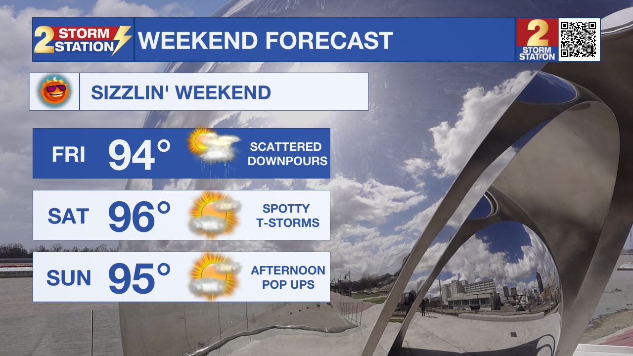
Up Next: The weekend will be dominated by heat, with afternoon highs in the mid-90s and feels-like temperatures topping 105° at times. Each day will bring a 20–30% chance of scattered afternoon or evening showers and storms. A few storms could pack gusty winds up to 50 mph, frequent lightning, and heavy rain capable of briefly flooding streets if one lingers.
Next week, high pressure sticks around, keeping highs in the low to mid-90s and daily low-end storm chances. Even with occasional clouds or showers, the heat and humidity will stay intense until the pattern changes later in the week.

The Tropics: Erin became the first hurricane of the 2025 season Friday morning with maximum sustained winds of 75mph as it continues to move west at around 18 mph. Erin is location just eat of the Caribbean and will take a north/northwest turn over the weekend as it continues to strengthen. Residents of the northern Leeward Islands, Virgin Islands, and Puerto Rico should monitor its progress. Swells from Erin could reach these areas by the weekend, creating dangerous surf and rip current conditions.
Trending News
An Air Force Reserve Hurricane Hunter aircraft has been investigating the disturbance located along the coast of northeastern Mexico and southern Texas. Aircraft wind data and coastal Doppler radar data indicate that a closed circulation is not present and the trough axis associated with the disturbance is closer to the coast than previously estimated. Therefore, the possibility of formation is diminishing with only a few hours left over water. Regardless of development, locally heavy rainfall is possible along portions of northeastern Mexico and southern Texas over the next day or so
Get the latest 7-day forecast and real-time weather updates HERE.
Watch live news HERE.
– Emma Kate C.
More News
