

Latest Weather Blog
Friday AM Forecast: Warm and humid Memorial Day Weekend, Afternoon isolated storms possible
This weekend will bring classic "summertime in Louisiana" weather: mild mornings followed by warm, humid afternoons, with a chance of isolated storms during the later hours of the day. Not everyone will experience rain each day, but it's a good idea to keep an eye on the radar each afternoon just in case.
Today & Tonight: Friday will be warm with the returning humidity. A few patchy areas of fog may develop around sunrise but the majority of the day will see a mix of sun and clouds. Isolated showers and thunderstorms may develop this afternoon and evening as a front lifts north through the region. As with all summertime storms, one or two may be on the stronger side with heavy downpours and small hail possible.
Overnight, clouds will increase again, limiting morning lows to the 70s with a sticky feel.
Memorial Day Weekend: Saturday and Sunday will start with mild mornings in the 70s, warming up to the low 90s by the afternoon with high humidity. A few isolated storms could pop up in the afternoon, but not everyone will get rain. Still, it's a good idea to keep an eye on the radar, as any passing storms could impact outdoor plans.
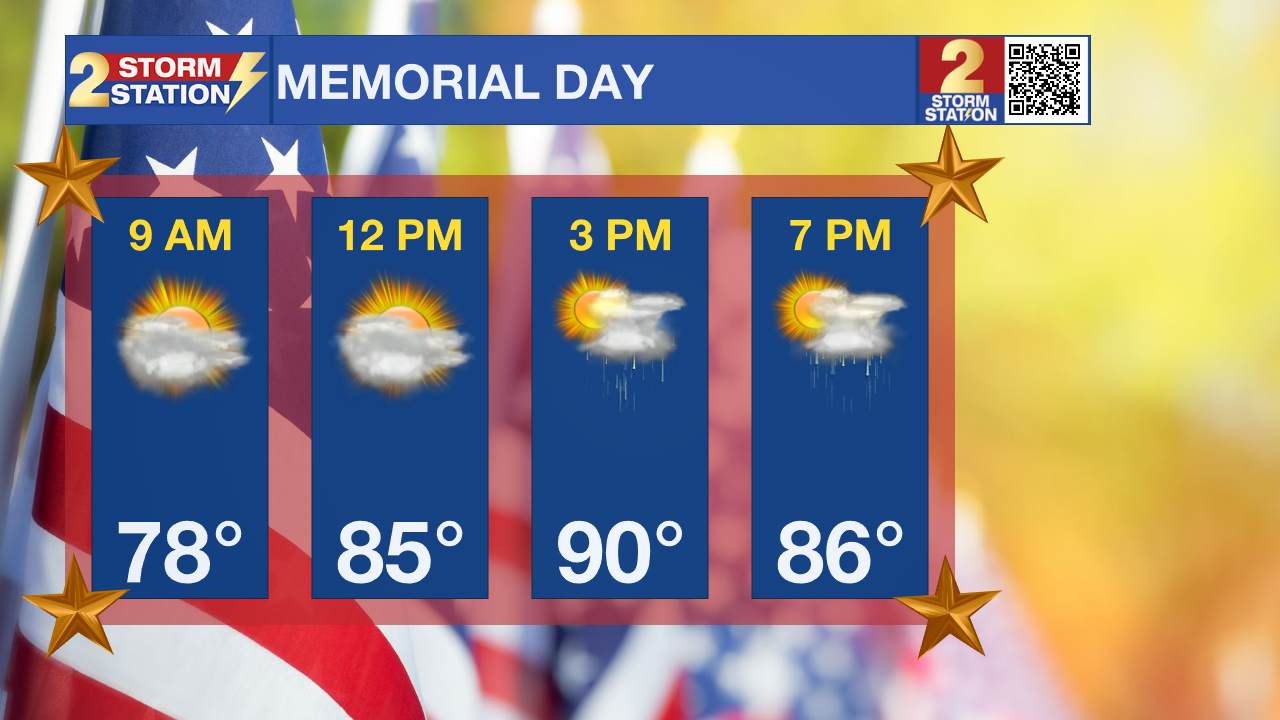
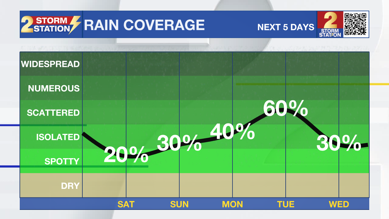
Memorial Day: Moisture in the atmosphere will peak on Memorial Day; this will increase coverage of afternoon shower and thunderstorm activity. About 40% of the 13 Parish, 2 County Forecast Area is expected to receive rain at some time on Memorial Day. Right now, it does not look like a washout, but some outdoor plans could be interrupted, especially during the afternoon. Temperatures will remain warm, near 90 degrees, Monday afternoon.
Trending News
Up Next: The latest weather models show a front moving toward our area on Monday. It looks like it will stall just north of us for about a day before moving through on Tuesday. When it does pass through the Capital Area, that's when we'll likely see the most rain and possibly a few strong storms. Exact timing remains up in the air for now, but we are expecting scattered rain chances on both Tuesday and Wednesday. Be sure to check in with the Storm Station this weekend for updates. No matter when the rainmaker arrives, expect more clouds next week, which will help keep high temperatures in the 80s through midweek.
Get the latest 7-day forecast and real-time weather updates HERE.
Watch live news HERE.
– Emma Kate C.
The Storm Station is here for you, on every platform. Your weather updates can be found on News 2, wbrz.com, and the WBRZ WX App on your Apple or Android device. Follow WBRZ Weather on Facebook and X for even more weather updates while you are on the go.
More News
