

Latest Weather Blog
Friday PM Forecast: Another dry October weekend as fire danger increases
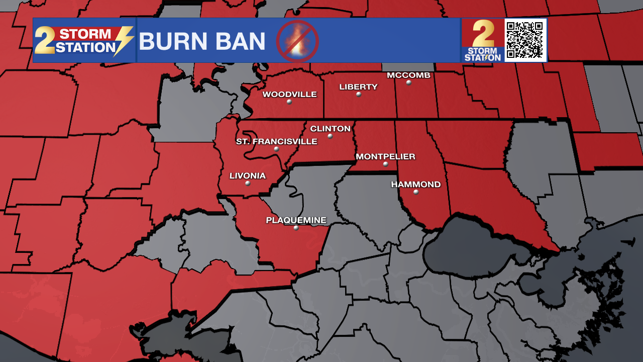
The Baton Rouge Area will enjoy warm, sunny afternoons and crisp, cool nights straight through next week. However, extremely dry air and worsening drought conditions will keep the fire danger elevated, with many parishes and counties under burn bans.
No Rain: drought conditions will worsen over the next week
Fire Danger: low humidity and warm conditions will allow fires to spark easily
Next Cold Front: a weak one next week, likely without any rain or major changes
Tonight, Tomorrow and Sunday: Clear skies and light winds will allow warmth to escape rapidly into space, dropping low temperatures into the low 50s tonight. Consider adding a layer for the high school football games and if heading outside early in the morning. Sunny skies will persist all day, with high temperatures warming into the mid 80s on Saturday. Minimal change is expected for the second half of the weekend, with morning lows in the low 50s giving way to afternoon highs in the low 80s. It is possible a few clouds show up Sunday.
Trending News
Easterly winds will pick up slightly to around 10 mph over the weekend. Because humidity levels will drop into the 20% to 30% range during the afternoon, dry grass and fallen leaves will catch fire easily. Please respect all parish burn bans and hold off on outdoor bonfires or yard debris burning.
Up Next: The comfortable and dry stretch of weather will continue right through next week. High temperatures will consistently reach the lower 80s each afternoon under mostly sunny skies. Overnight lows will stay seasonably cool, staying between 50 and 52 degrees each night.
While a weak upper-level atmospheric disturbance will slide far north of Louisiana by midweek, our persistent easterly winds will continue to pump dry air straight into the Capital Area. As a result, rain chances will remain near zero percent through at least Thursday, and drought conditions will continue to worsen.

Get the latest 7-day forecast and real-time weather updates HERE.
Watch live news HERE.
The Tropics: The Gulf of Mexico, Caribbean Sea, and broader Atlantic Basin will remain completely quiet. Tropical cyclone formation is not expected anywhere in the North Atlantic over the next 7 days.
– Josh
The Storm Station is here for you, on every platform. Your weather updates can be found on News 2, wbrz.com, and the WBRZ WX App on your Apple or Android device. Follow WBRZ Weather on Facebook and X for even more weather updates while you are on the go.
More News

