

Latest Weather Blog
Friday PM Forecast: pesky showers slow to lose grip on Capital Area
As we head into the weekend, things are looking a bit unsettled thanks to a slow-moving storm system spinning between Louisiana and Mississippi. This system will keep us under cloudy skies and maintain some showers through the weekend.
Here is a breakdown of what to expect:
-Mother’s Day Weekend: times of clouds, isolated showers, not too warm
-Monday: lingering showers
-Tuesday & Beyond: trending drier and much warmer
Tonight: Widespread rain will gradually taper into the overnight hours. Precipitation will not totally shut down, though, and spotty to isolated showers will stay possible right through dawn. Stringing together multiple dry hours may be difficult. Lows will stop in the low 60s.
Mother’s Day Weekend: Some showers and thunderstorms are likely both Saturday and Mother’s Day, with each seeing about an isolated coverage in rain. Neither day will be a washout, but you may need to dodge a few showers, particularly in the afternoon. So while it may not be ideal for extended outdoor plans, some dry windows are expected — just have a backup plan ready if Mother Nature decides to join the party. Also, don’t be surprised by some small hail flying from any thunderstorms due to the unusually cold air aloft, which is the overall cause for this dreary pattern. Skies will remain mostly cloudy with occasional breaks of sun. Highs will hover in the upper 70s with lows in the low 60s.
Trending News
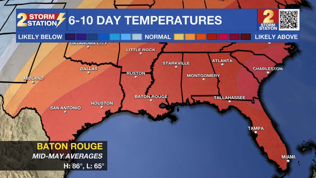
Up Next: Monday continues the unsettled trend with lingering clouds and about a 30% coverage of showers, but conditions begin to dry out as the nuisance storm system finally moves out of our area. Then, buckle up—because summer is making a fast entrance. Starting Tuesday, we’ll see sunshine and rapidly warming temperatures. Expect highs to climb into the mid-80s Tuesday, upper 80s Wednesday, and by Thursday and Friday, we're looking at 90 and 91 degrees, respectively. That’s thanks to a strong ridge building over the Gulf, locking in hot and mostly dry weather through late week.
River Flooding: The National Weather Service has issued a RIVER FLOOD WARNING for the Mississippi River at Red River Landing, Baton Rouge, and Donaldsonville, the Atchafalaya River at Morgan City, and the Tangipahoa River at Robert. For the latest levels and forecasts, CLICK HERE.
Get the latest 7-day forecast and real-time weather updates HERE.
Watch live news HERE.
– Josh
The Storm Station is here for you, on every platform. Your weather updates can be found on News 2, wbrz.com, and the WBRZ WX App on your Apple or Android device. Follow WBRZ Weather on Facebook and X for even more weather updates while you are on the go.
More News
