

Latest Weather Blog
Friday PM Forecast: Watching for storms as LSU and Southern prepare for home openers
Following week one of high school football, Baton Rouge is gearing up for a big college football Saturday. Keep an eye on the skies, as storms could impact game day. While a full washout is not expected, outdoor tailgaters should remain weather-aware and seek shelter if lightning threatens.
Tonight & Tomorrow: Afternoon thunderstorms will fizzle toward nightfall, but don't completely rule out a stray overnight shower. Otherwise, expect partly cloudy skies into Saturday morning, with lows in the mid-70s. Saturday may feature more sun earlier in the day, boosting temperatures and perhaps popping storms off a little earlier. A washout is not expected, but scattered thunderstorms will be a possibility as early as mid-to-late morning.

Use the slider to advance through the next 24 hours of Futurecast
Sporadic downpours will remain in the area through the afternoon and possibly early evening but will generally taper closer to sunset. Any of these storms could briefly bring heavy rain and dangerous lightning. Highs will likely peak in the low 90s.
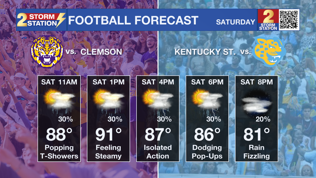
Tigers/Jags Showdown: The Capital City will be buzzing with activity as LSU and Southern host their first football matches of the season on Saturday. With daytime thunderstorms firing, game day festivities could face a few disruptions. Even if cell service drops and the Storm Station Weather App is unavailable, there are still several ways to track developing weather — CLICK HERE.
While heavy rain might be inconvenient, lightning is the real danger. Tailgaters should remain alert for thunder and move indoors or into an enclosed vehicle immediately upon hearing it. Remember: if thunder is within earshot, lightning is close enough to strike. Isolated activity might linger after kickoff, but storms will become less of an issue into the night. Look for a kickoff temperature in the mid-80s.
Trending News

Up Next: Expect highs to creep into the mid-90s for the rest of Labor Day weekend as a ridge of high pressure builds back in over the region. Thanks to leftover moisture, still expect a handful of afternoon thunderstorms. Typical late-summer heat will hang around next week also, though another arriving disturbance could tick up rain coverages toward midweek.
Get the latest 7-day forecast and real-time weather updates HERE.
Watch live news HERE.
The Tropics: No tropical development is expected over the next seven days across the Gulf, Caribbean, and Atlantic.
— Meteorologist Malcolm Byron
The Storm Station is here for you, on every platform. Your weather updates can be found on News 2, wbrz.com, and the WBRZ WX App on your Apple or Android device. Follow WBRZ Weather on Facebook and X for even more weather updates while you are on the go.
More News

