

Latest Weather Blog
Monday AM Forecast: Labor Day forecast looks pleasant
We start the new month with Labor Day! Somewhat drier air is in place, and a pleasant day is expected. Temperatures will be warm, but rainfall shouldn’t interrupt outdoor plans for the most part.
Labor Day and Tuesday: The front that kept things unsettled most of last week is still drifting southward into the Gulf waters. Showers near the coast could hamper boaters. The rest of the region can expect partly cloudy skies with highs near 90. Winds will be light. Heading into the new work week, a weak front will drift southward. This could spark one or two showers. After, another push of dry air should keep us rain free by the end of the week.
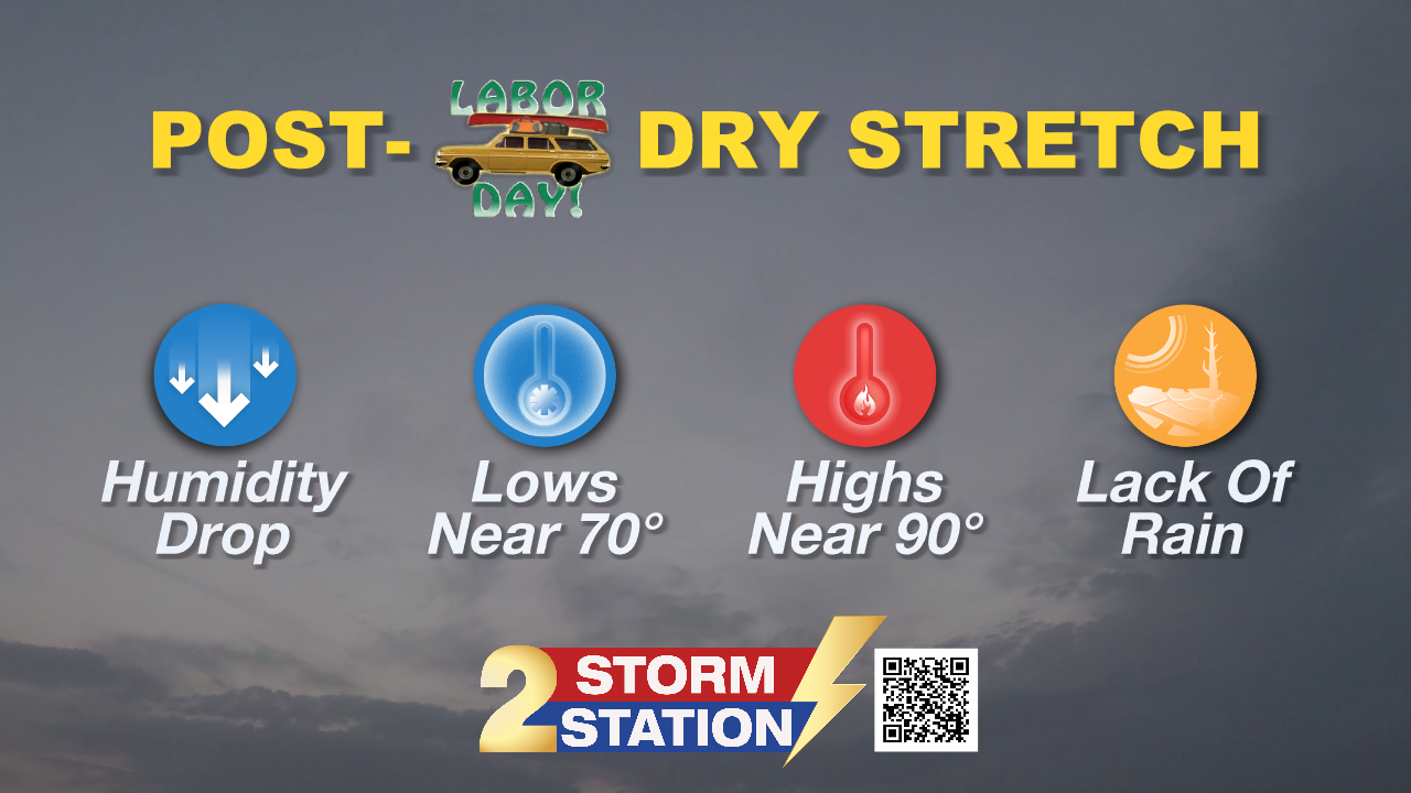
Up Next: Earlier forecasts were calling for another decent front to roll in this weekend. Some models are backing off, but at the very least, dry air should get back in by the weekend. At this time, chances for rain can’t be completely ruled out, but most weekend activities should be fine, including college football home games right here in Baton Rouge.
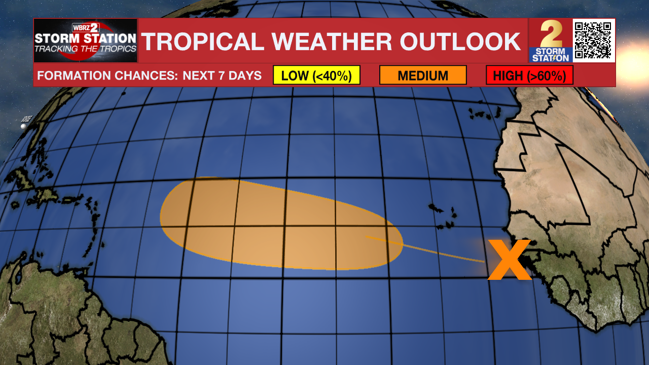
The Tropics: A tropical wave moved off the west coast of Africa Sunday. Conditions appear favorable for the slow development of this system while moving through the tropics this week. There is a medium chance of development in the next seven days. The next name up is Gabrielle.
Trending News
Get the latest 7-day forecast and real-time weather updates HERE.
Watch live news HERE.
– Dave
The Storm Station is here for you, on every platform. Your weather updates can be found on News 2, wbrz.com, and the WBRZ WX App on your Apple or Android device. Follow WBRZ Weather on Facebook and X for even more weather updates while you are on the go.
More News
