Monday AM Forecast: Another dry week ahead as temperatures warm
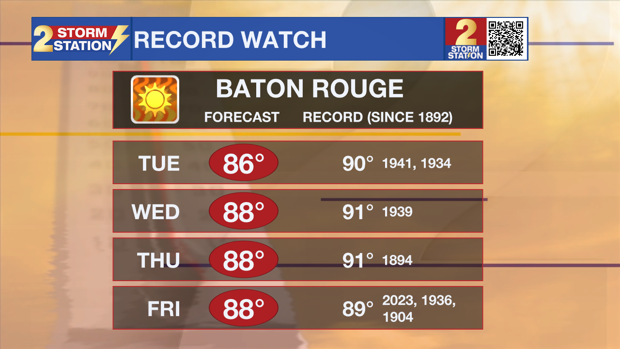
The workweek ahead will continue the now 16 day dry streak for the Capital Area. Temperatures will also remain above average, potentially flirting with record warmth by the end of the week.
Today & Tonight: Monday morning will be cool with temperatures north of I-10/12 dipping into the upper-40s and the Capital City seeing a morning low near 50 degrees. Conditions will quickly warm, back into the middle 80s this afternoon. It will be a comfortable day, with plenty of sunshine and low humidity. Winds also remain light out of the ENE between 5-10 mph. Overnight, mainly clear skies will allow for another cool start in the low 50s on Tuesday.
Up Next: Similar conditions should be expected through the workweek. Cool mornings in the 50s will be followed by warm afternoons in the 80's. With no rain and little cloud cover this week, afternoon temperatures will be 5-10° above average by the latter half of the workweek; some days flirting with record highs.

The entire month of October has only recorded one day with measurable rainfall (0.13" at the Metro Airport on October 4th). The remainder of the month has seen a lack of rain and continues to look unlikely in the next 7 days. Based on current trends, it's possible that this October could rank as one of the top 10 driest. The Storm Station will be keeping an eye on the drought status as a result. The next update comes on Thursday.
Get the latest 7-day forecast and real time weather updates HERE.
Trending News
Watch live news HERE.
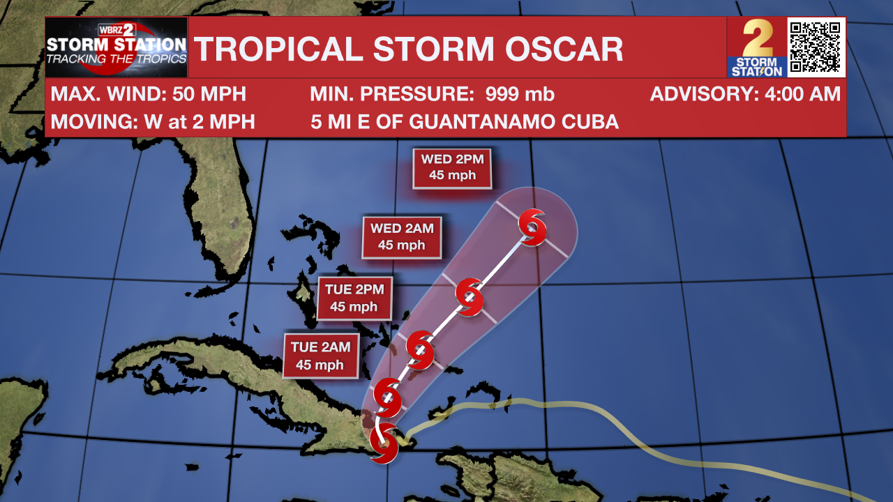
The Tropics: Oscar made landfall twice on Sunday, first on Great Inagua Island early in the morning and then in eastern Cuba in the afternoon. Oscar is a tiny system, ranking as one of the smallest hurricanes on record. As of early Monday, the storm has weakened to Tropical Storm strength as is curves to the northeast over water on a path toward the Bahamas. The system is forecast to maintain tropical storm status as it passes by the Bahamas. By midweek, increasingly hostile conditions will allow the storm to dissipate.

No other tropical development is expected in the next seven days.
-Emma Kate Cowan
The Storm Station is here for you, on every platform. Your weather updates can be found on News 2, wbrz.com, and the WBRZ WX App on your Apple or Android device. Follow WBRZ Weather on Facebook and Twitter for even more weather updates while you are on the go.


