

Latest Weather Blog
Monday AM forecast: Dry today. Spotty showers later this week
Cool start, comfortable afternoon with dry air in place on Monday. Warming trend begins this week with rain chances returning late.

Today and tonight: A cool start early Monday gives way to a pleasant afternoon with highs climbing into the mid to upper 70s under a mix of sunshine and high clouds. Dry air remains firmly in place, keeping rain chances near zero and humidity noticeably lower than recent days. Winds stay light to moderate out of the northeast, and overall conditions will feel very comfortable.

Use the slider to advance through the next 24 hours of Futurecast
Trending News
Up Next: Another cool morning is expected on Tuesday before temperatures begin trending warmer through midweek. By Wednesday and Thursday, highs climb back into the 80s with a gradual return of moisture, though rain chances remain limited and spotty at best.
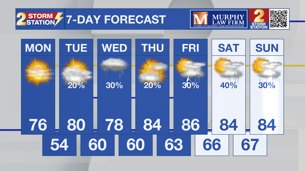
What to look out for: Very dry air will drop humidity levels to around 25 percent in some areas Monday afternoon, especially across south Mississippi and nearby parts of southeast Louisiana. That increases fire danger, so avoid outdoor burning and be cautious with anything that could spark a fire. A steady warming trend continues through the week, with better rain chances developing toward Friday and into the weekend.
Get the latest 7-day forecast and real-time weather updates HERE.
Watch live news HERE.
– Dave
The Storm Station is here for you, on every platform. Your weather updates can be found on News 2, wbrz.com, and the WBRZ WX App on your Apple or Android device. Follow WBRZ Weather on Facebook and X for even more weather updates while you are on the go.
More News
