

Latest Weather Blog
Monday AM Forecast: Spring-like conditions return, Few mornings with fog possible
A warming trend takes over this week as sunny skies and spring-like conditions return to the Capital Area. A few morning commutes may be interrupted by patchy areas of fog.
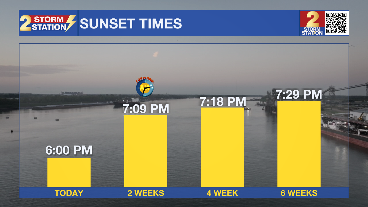
Today & Tonight: Watch out for wet roadways and a few lingering showers during the Monday morning commute. By lunchtime, conditions will be dry but skies will remain mostly cloudy. Look for highs this afternoon in the middle 60s. Some clearing of the skies will be possible by sunset tonight - which sets at 6:00 pm for the first time in months! Overnight, mainly clear skies will allow for temperatures to fall into the mid-40s. A few areas of fog will likely develop and could limit visibility during the Tuesday morning commute.
Up Next: Patchy areas of fog will burn off and lead to mostly sunny skies on Tuesday and Wednesday. Look for cool mornings in the 40s and comfortable afternoons in the 70s. On Thursday, a weak cold front will move through the state. With limited moisture available in the atmosphere at the time, rain appears to be limited with this frontal passage. Behind the system, afternoons will be a couple of degrees cooler before they warm again over the weekend. No major rainmaker is expected over the next 7 days.
Get the latest 7-day forecast and real-time weather updates HERE.
Trending News
Watch live news HERE.
- Emma Kate C.
The Storm Station is here for you, on every platform. Your weather updates can be found on News 2, wbrz.com, and the WBRZ WX App on your Apple or Android device. Follow WBRZ Weather on Facebook and X for even more weather updates while you are on the go.
More News
