

Latest Weather Blog
Monday AM forecast: Sunny skies and mild temperatures
One more frosty morning to start the week, followed by a noticeable warmup. Rain returns midweek, with colder mornings possible again later this week behind the next front.

Today and tonight: Many locations are starting Monday morning at or below freezing, especially in the northern areas, but this will be the final widespread freeze in this stretch. Sunshine and lighter winds will allow temperatures to rebound quickly, with afternoon highs climbing into the lower 60s. Tonight will be much milder as moisture begins to return and temperatures stay well above freezing. Some cloudiness will be back in place by early Tuesday.

Use the slider to advance through the next 24 hours of Futurecast
Up Next: Tuesday turns noticeably warmer and more humid, with highs reaching the 60s and a few spots possibly touching 70. Clouds increase Tuesday afternoon ahead of the next cold front, with rain developing Tuesday night into Wednesday morning. Rainfall totals remain under one inch, and no significant impacts are expected.
Trending News
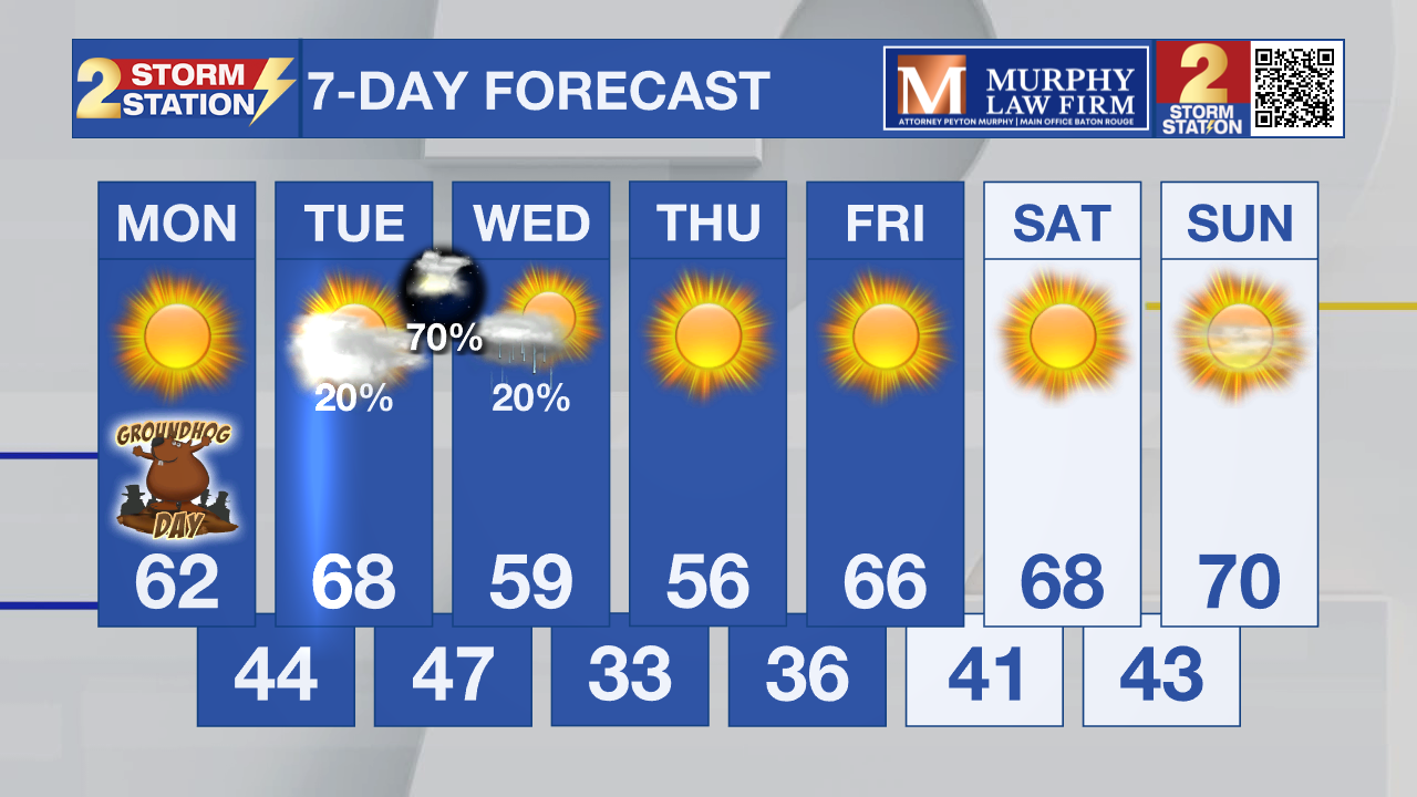
What to look out for: After the midweek cold front moves through early Wednesday, cooler air returns late week. Temperatures near freezing are possible again Thursday and Friday mornings. Gusty winds behind the front will lead to a blustery day on Wednesday.
Get the latest 7-day forecast and real-time weather updates HERE.
Watch live news HERE.
– Dave
The Storm Station is here for you, on every platform. Your weather updates can be found on News 2, wbrz.com, and the WBRZ WX App on your Apple or Android device. Follow WBRZ Weather on Facebook and X for even more weather updates while you are on the go.
More News
