

Latest Weather Blog
Monday PM Forecast: Cold front to shake things up after a quiet week
Sunshine will be the main story moving forward, pushing afternoon highs into the low 90s each day this week. However, that warm trend gets disrupted heading into the weekend as another cold front targets the area. The shift in pattern could set up more comfortable temperatures just in time for the weekend.
Tonight & Tomorrow: Skies will remain mostly clear overnight, allowing temperatures to drop to a comfortable low near 64°. While it won't be widespread, patchy shallow fog cannot be ruled out for a few areas, particularly near I-55 and the Pearl River. Moving into Tuesday, the region will stay locked in a dry and unseasonably warm weather pattern. Expect abundant sunshine with hardly a cloud in sight to clutter up the pretty blue sky.
Up Next: An expansive region of high pressure, made up of warm, sinking air, will sit over the Gulf Coast for the rest of the workweek. This will keep rain chances nearly extinct and temperatures well above average. Highs will remain in the low 90s, which runs about 10° above average for mid-October, even getting close to a few records on occasion. However, the humidity will be held in check, which will make the heat more manageable.
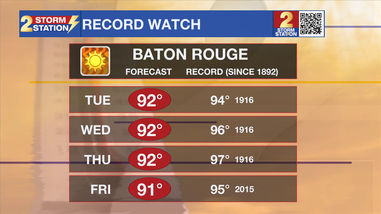
A more welcome change arrives just in time for the weekend as a cold front slips through the region. It looks like a dry front, with little to no rain expected as it passes through on Friday night. That said, it will be enough to drop high temperatures into the low 80s, perfect for a Saturday morning kickoff in Death Valley. By Sunday morning, lows should find the mid-50s. The cooldown appears to be short-lived, however, as temperatures warm right back up into next week.

Trending News
Get the latest 7-day forecast and real-time weather updates HERE.
Watch live news HERE.
The Tropics: A broad region of low pressure located a few hundred miles east of the Cabo Verde Islands continues to produce a disorganized area of showers and thunderstorms. Conditions will be barely conducive for tropical formation over the next day or so before upper-level winds become too strong for further development on Tuesday. Overall tropical development odds remain low at this time. Regardless, this system is of no concern to Louisiana.

— Emma Kinchen, Malcolm Byron
The Storm Station is here for you, on every platform. Your weather updates can be found on News 2, wbrz.com, and the WBRZ WX App on your Apple or Android device. Follow WBRZ Weather on Facebook and X for even more weather updates while you are on the go.
More News

