

Latest Weather Blog
Monday PM Forecast: Humidity extending its vacation beyond Labor Day
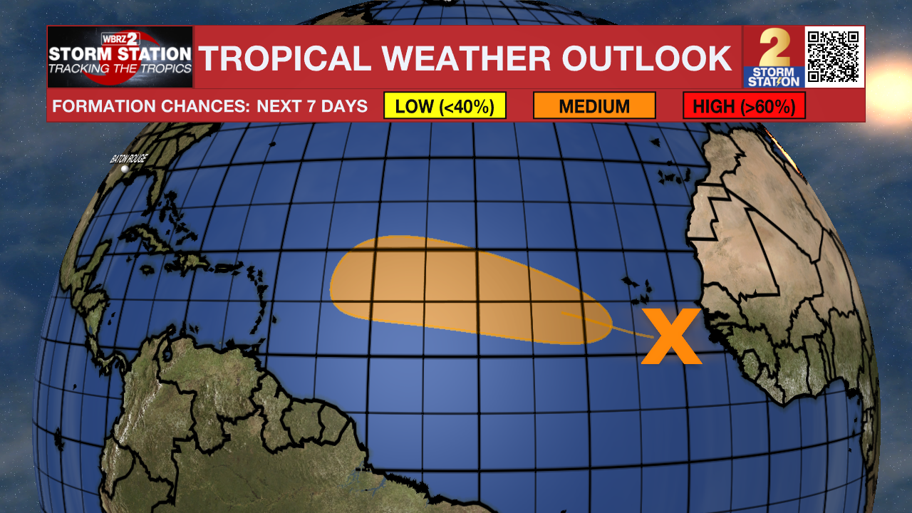
Humidity will remain in check for the first few days of September. A general lack of storm activity will accompany the more comfortable feel. Meanwhile, the Storm Station is also keeping an eye on a tropical wave in the eastern Atlantic.
Tonight & Tomorrow: Skies won’t be nearly as cloudy as they were early Monday, but still expect a few passing clouds through the evening and overnight period. Baton Rouge will see overnight lows dropping to near 70° for another night, with areas north of I-12 challenging the upper 60s. Tuesday looks largely dry and warm with a high near 90°. Humidity will remain a notch or two below the summer norm, except along the immediate coast. As for rain, a stray shower isn’t off the table as an upper-level disturbance passes by. But that system will be acting on a moisture-starved atmosphere, so don’t expect too many storms to fire.
Up Next: Another reinforcement of dry air will come around midweek. This could nudge lows into the upper 60s even in Baton Rouge on Wednesday morning. Afternoons will be warm, with highs in the low 90s, and rain will be scarce. Humidity will creep north by the end of the week, though what’s felt will depend on location. Areas north of I-10/12 should keep a relatively “comfortable” feel, whereas areas south will feel steamy at times. Temperatures will stair-step higher during this timeframe. For instance, highs could reach the mid-90s by Friday. But all things considered, this isn’t unusual for early September. Such conditions may last into the first part of the weekend. As of now, no major issues are anticipated for the home openers on the Bluff and at Tiger Stadium on Saturday.
There are some signs of another shot of dry air coming in for the second half of the weekend. It is something to watch, but it’s not set in stone just yet. Should it pan out, the likely result would be conditions returning to about where they are right now.
The Tropics: A tropical wave in the far eastern tropical Atlantic is producing a disorganized cluster of showers and thunderstorms. Conditions appear favorable for the gradual development of this system while moving through the tropical Atlantic this week. There is a medium chance of development in the next seven days. The next name up is Gabrielle.
Trending News
Get the latest 7-day forecast and real-time weather updates HERE.
Watch live news HERE.
— Meteorologist Malcolm Byron
The Storm Station is here for you, on every platform. Your weather updates can be found on News 2, wbrz.com, and the WBRZ WX App on your Apple or Android device. Follow WBRZ Weather on Facebook and X for even more weather updates while you are on the go.
More News
