

Latest Weather Blog
Monday PM Forecast: Spring-like warmth, morning fog, eventually storms
Dense fog will greet the Capital Area on many mornings this week. Followed by partial clearing, spring-like warmth will take over during the afternoon. Eventually, rain returns to the forecast, though the timing looks less than ideal.
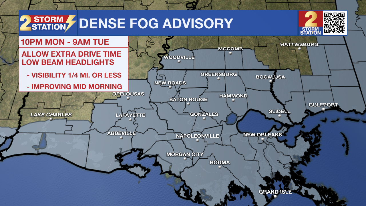
Tonight & Tomorrow: A mostly clear evening will give way to another round of low clouds and fog overnight. Another Dense Fog Advisory will be in effect from 10 p.m. Monday through 9 a.m. Tuesday for the entire Capital Region. When driving in fog, be prepared for sudden changes in visibility, use low-beam headlights, and leave more following distance. Also, consider leaving a few minutes earlier for work. Commute temperatures will be mild, in the mid-50s. Clouds and fog will lift by mid-to-late morning, leaving behind a mixture of sun and high clouds. Even a little sunshine will warm temperatures fast. Look for a high in the mid to upper 70s.
Up Next: Expect a familiar pattern through the rest of the week. Mornings will be mild with lows in the 50s and areas of fog, whereas afternoons bring a mixture of clouds and sun with highs in the mid-to-upper 70s. Lingering fog could keep highs a degree or two cooler, whereas faster clearing would allow slightly warmer highs. A minor disturbance will increase cloud cover early Wednesday, which may keep fog more patchy for that morning. The same system may also bring isolated showers on Wednesday. However, the midweek setup will be “small potatoes” in comparison to the one that’s coming over the weekend.
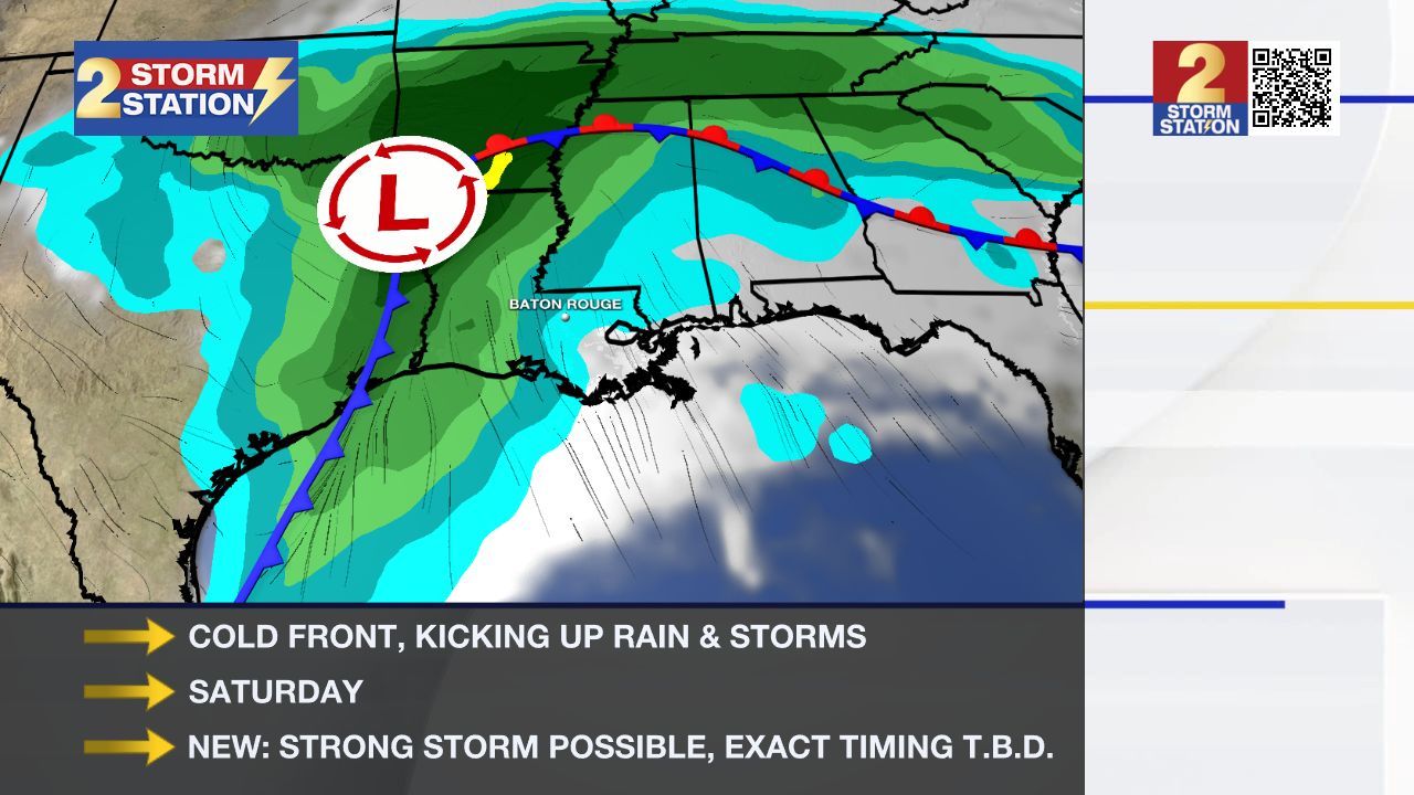
Weekend Storms: A potent storm system will roll through the Capital Area this weekend, driving a cold front through the region. The front will kick up a wave of showers and storms. A strong storm is not off the table either. This situation warrants close monitoring, especially with Valentine’s Day, LSU Baseball, and Mardi Gras parades on the calendar. While exact timing is still to be determined, rain and lightning appear likely at some point on Saturday or Saturday night. A faster or slower arrival could keep some plans in the clear, so don’t cancel plans just yet. Stay connected with the Storm Station this week as the forecast continues to come into focus.

Trending News
Get the latest 7-day forecast and real-time weather updates HERE.
Watch live news HERE.
— Meteorologist Malcolm Byron
The Storm Station is here for you, on every platform. Your weather updates can be found on News 2, wbrz.com, and the WBRZ WX App on your Apple or Android device. Follow WBRZ Weather on Facebook and X for even more weather updates while you are on the go.
More News
