

Latest Weather Blog
Monday PM Forecast: Winter returns to end 2025 with subfreezing mornings
2025 will end on a chilly note, with subfreezing temperatures likely during the final mornings of the year. Heavy coats will be needed, pets should have adequate shelter, and plants will need protection. While pipes should generally be okay, it’s still a good idea to take precautions ahead of Wednesday morning with widespread 20s expected. Temperatures rebound during the first few days of 2026.
Tonight & Tomorrow: Cold air will continue to pour into the Capital Area overnight. Temperatures will fall through the 40s during the evening and 30s overnight. A light freeze looks likely along and north of I-10 by morning, with temperatures hovering just above 32° closer to the coast.
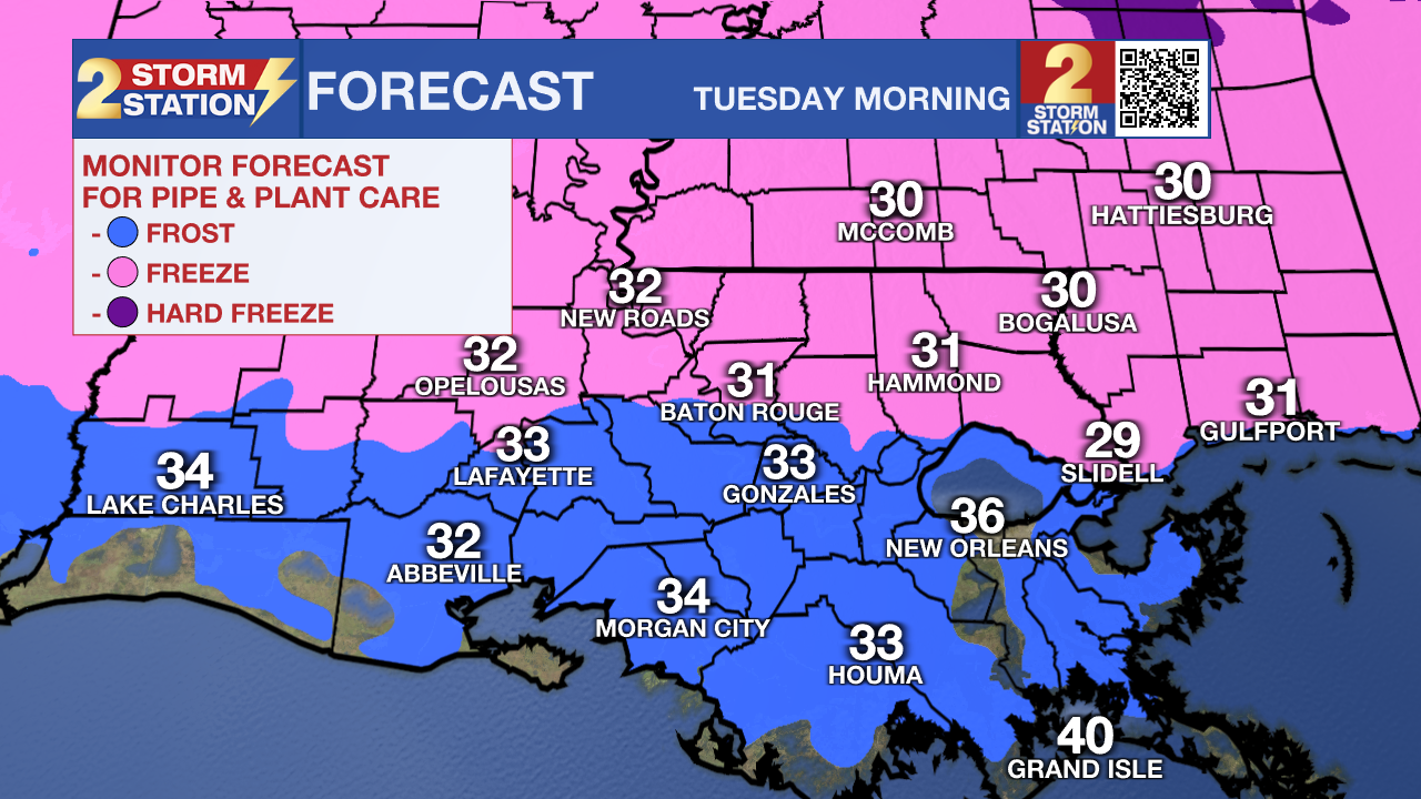
Winds will slacken through the night, but still, a subtle breeze will place wind chills in the 20s leading up to sunrise. The National Weather Service has issued a Cold Weather Advisory for areas north of I-12, which is issued for this area when temperatures or wind chills may fall to 20° or lower. While wind chills that low look unlikely, the change will still be jarring. After several days of 70s and 80s, the morning cold will feel downright frigid.
Passing high clouds overnight will bleed over into the morning hours. Skies will turn sunny by afternoon, but it won’t help temperatures much. Look for a high in the upper 40s to near 50° on Tuesday.
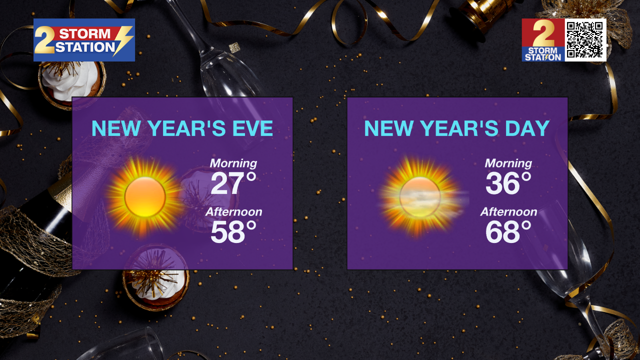
Up Next: The coldest part of the week will come on the morning of New Year’s Eve as temperatures drop into the 20s for most. Several hours of subfreezing cold are expected, especially farther away from the immediate coast. Temperatures will slowly moderate throughout the rest of the week, with lows climbing out of freeze territory. Meanwhile, highs will rebound quickly, nearing 60° on New Year's Eve and pushing 70° on New Year's Day. By Friday, thermometers will register in the mid-70s. That warmup comes ahead of another cold front, which may bring a few showers and storms between Friday and Saturday. This front looks fairly weak, delivering only a modest and brief drop in temperatures over the weekend.
Trending News

Get the latest 7-day forecast and real-time weather updates HERE.
Watch live news HERE.
— Meteorologist Malcolm Byron
The Storm Station is here for you, on every platform. Your weather updates can be found on News 2, wbrz.com, and the WBRZ WX App on your Apple or Android device. Follow WBRZ Weather on Facebook and X for even more weather updates while you are on the go.
More News
