NOAA releases outlook for the 2024-2025 winter
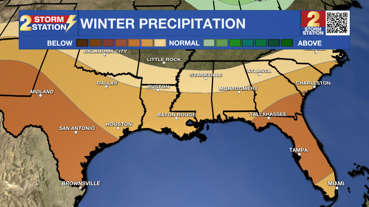
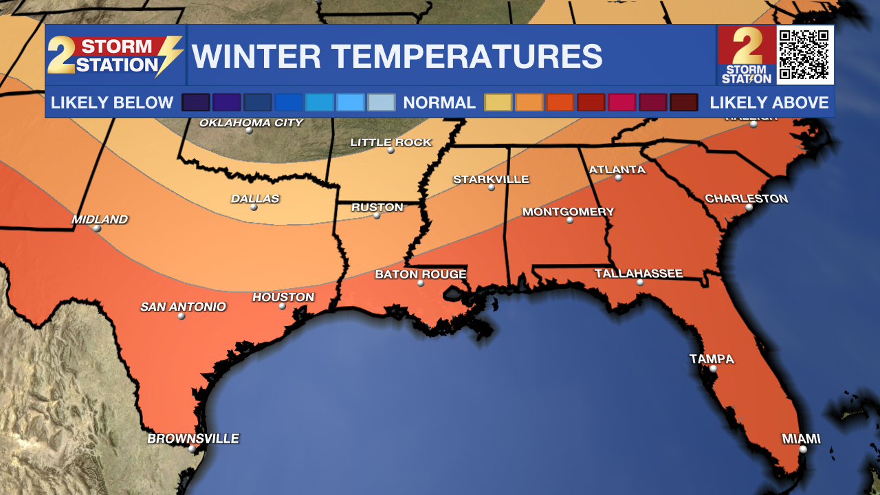
With the first fall chill across the Capital Area, it is a reminder that winter is just around the corner. The latest indications suggest that this winter will be warmer and drier than average. Read on for what this could mean for snow chances.
The first signs of drought have recently become evident across southern Louisiana. The lack of rainfall looks to continue, as below average rainfall is expected this winter. Drought development is likely around the Capital Area as we head into the winter months.

NOAA also does extended forecast for temperatures. While there might be a few colder spells, temperatures will be a decent bit above average. So if you are hoping for snow, the combination of warmer than average, and drier than average means snow is even less likely than usual.
Trending News

A lot goes into these long range forecast, but one big tool forecasters use is the El Niño-Southern Oscillation (ENSO). This is not only useful for the tropics, but for temperature and rainfall as well. El Niño favors cool and wet winters, while La Niña favors warm and dry winters.
Currently, we are in a neutral ENSO phase. Latest observations suggest waters are beginning to cool across the equatorial Pacific, which suggest we are heading into a La Niña. This should persist throughout the winter, leading to southeast Louisiana having a warm and dry winter.
The Storm Station is here for you, on every platform. Your weather updates can be found on News 2, wbrz.com, and the WBRZ WX App on your Apple or Android device. Follow WBRZ Weather on Facebook and Twitter for even more weather updates while you are on the go.


