

Latest Weather Blog
Saturday AM forecast: Game Day in Baton Rouge!
Saturday brings a hot and steamy setup to Baton Rouge, with both LSU and Southern hosting home games. The best chance for storms comes during the afternoon, including the tailgating hours, while conditions should gradually improve for the early-evening kickoffs.

Football Forecast: If you're heading out for tailgating this afternoon, be prepared for scattered to numerous showers and thunderstorms. With plenty of moisture in place, storms could produce heavy rain and dangerous lightning.
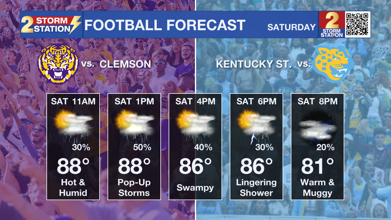
There will be periods of dry weather in between showers and storms. However, a few storms could linger around kickoff, so keep an eye on the radar before and during the games.
Trending News
Today and Tonight: Elsewhere, scattered to numerous showers and thunderstorms will develop through the late morning and afternoon as sea-breeze and other boundaries help trigger storms. Highs will generally stay in the upper 80s because of the clouds and rain, but the humidity will still make it feel warmer.

Use the slider to advance through the next 24 hours of Futurecast
Up Next: Storm chances decrease somewhat Sunday, but scattered thunderstorms remain possible, especially during the afternoon. More sunshine and less rain could allow temperatures to climb back into the lower 90s, with heat index values reaching around 100 to 108 degrees.
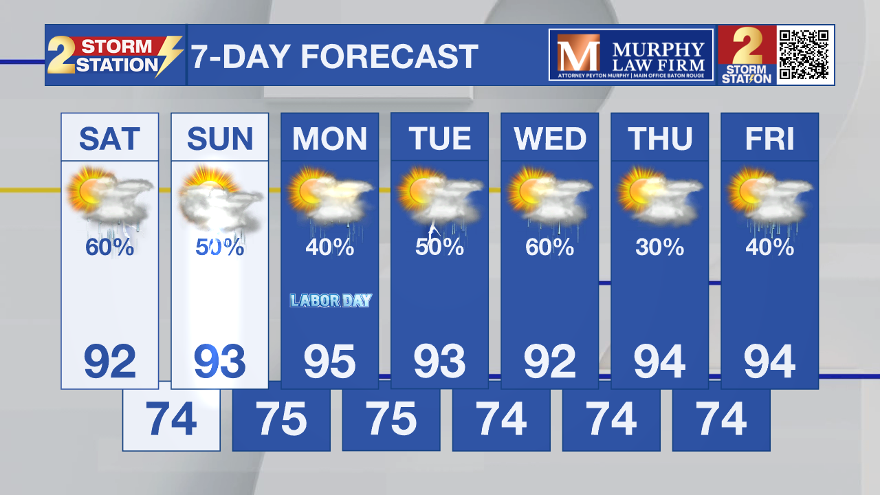
Labor Day will remain hot, humid, and stormy, with scattered afternoon storms and heat index values approaching or possibly exceeding advisory levels.
Tropics: The National Hurricane Center does not expect any tropical cyclone formation in the Gulf, Caribbean Sea, or Atlantic during the next seven days.
– Dave
Get the latest 7-day forecast and real-time weather updates HERE.
Watch live news HERE.
The Storm Station is here for you, on every platform. Your weather updates can be found on News 2, wbrz.com, and the WBRZ WX App on your Apple or Android device. Follow WBRZ Weather on Facebook and X for even more weather updates while you are on the go.
More News

