

Latest Weather Blog
Saturday AM forecast: Saturday AM forecast: Storms develop this afternoon, stronger storms overnight; rain ends early Easter
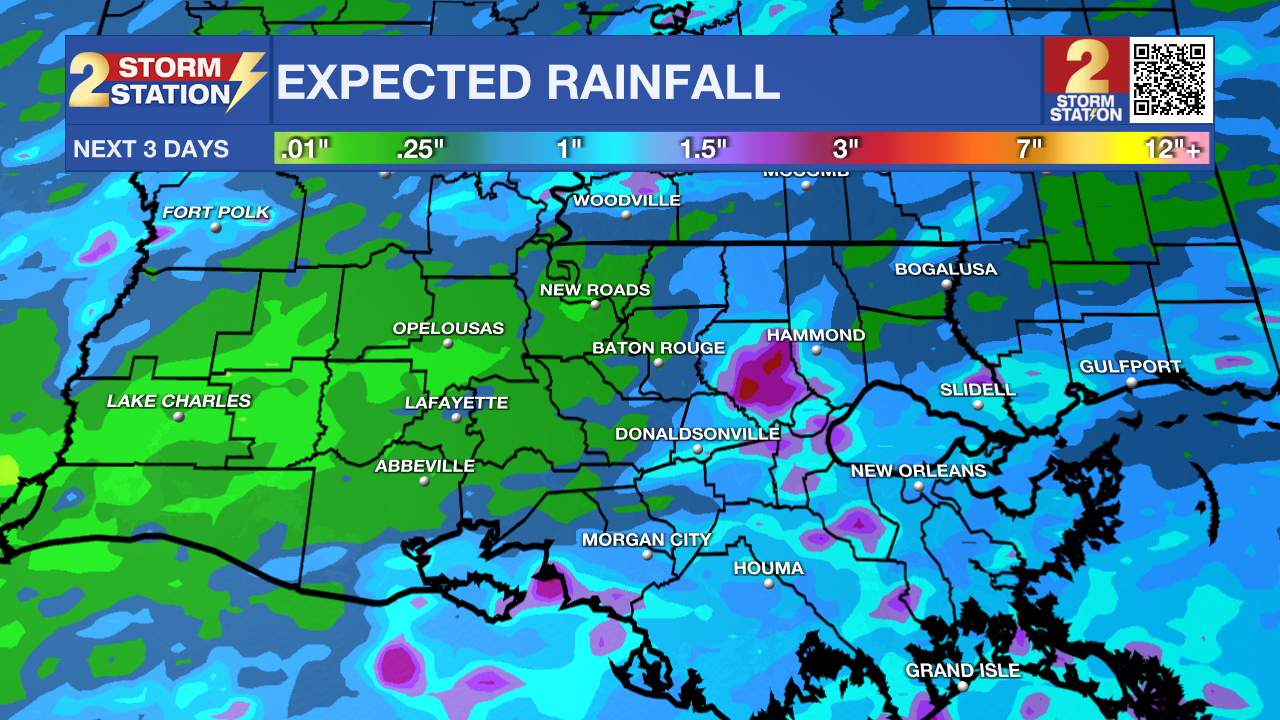
A more active weather day is underway across South Louisiana as storm coverage increases ahead of an approaching cold front. Showers and thunderstorms will become more widespread later in the day, with the potential for a few strong storms and locally heavy rainfall overnight.

Today and tonight: Expect a warm and humid start with temperatures quickly climbing into the upper 70s to low 80s. Showers and thunderstorms will become numerous by afternoon, with activity continuing into the evening. Some storms could become strong, producing gusty winds, along with locally heavy rainfall. The Storm Prediction Center has parts of the Capital Region under a Level 1 Marginal Risk for severe weather. Rainfall amounts will vary widely, but some areas could pick up several inches in a short period, which may lead to localized flooding. Storms will gradually shift and diminish overnight as the front approaches, but showers may linger into early Sunday.
Trending News
Up Next: The cold front moves through on Sunday, keeping rain and storm chances elevated, especially early in the day. Behind the front, conditions begin to dry, but clouds will hang on. Clearing is expected Monday with cooler temperatures, with highs dropping into the upper 60s to low 70s. The front may stall nearby, bringing some uncertainty into next week, but overall rain chances look more limited after Monday.

Use the slider to advance through the next 24 hours of Futurecast
What to look out for: A few storms could become strong to severe, with hail and damaging winds the main threats. In addition, heavy rainfall could lead to localized flooding, especially in areas that see repeated storms. Stay weather-aware through the afternoon and evening.
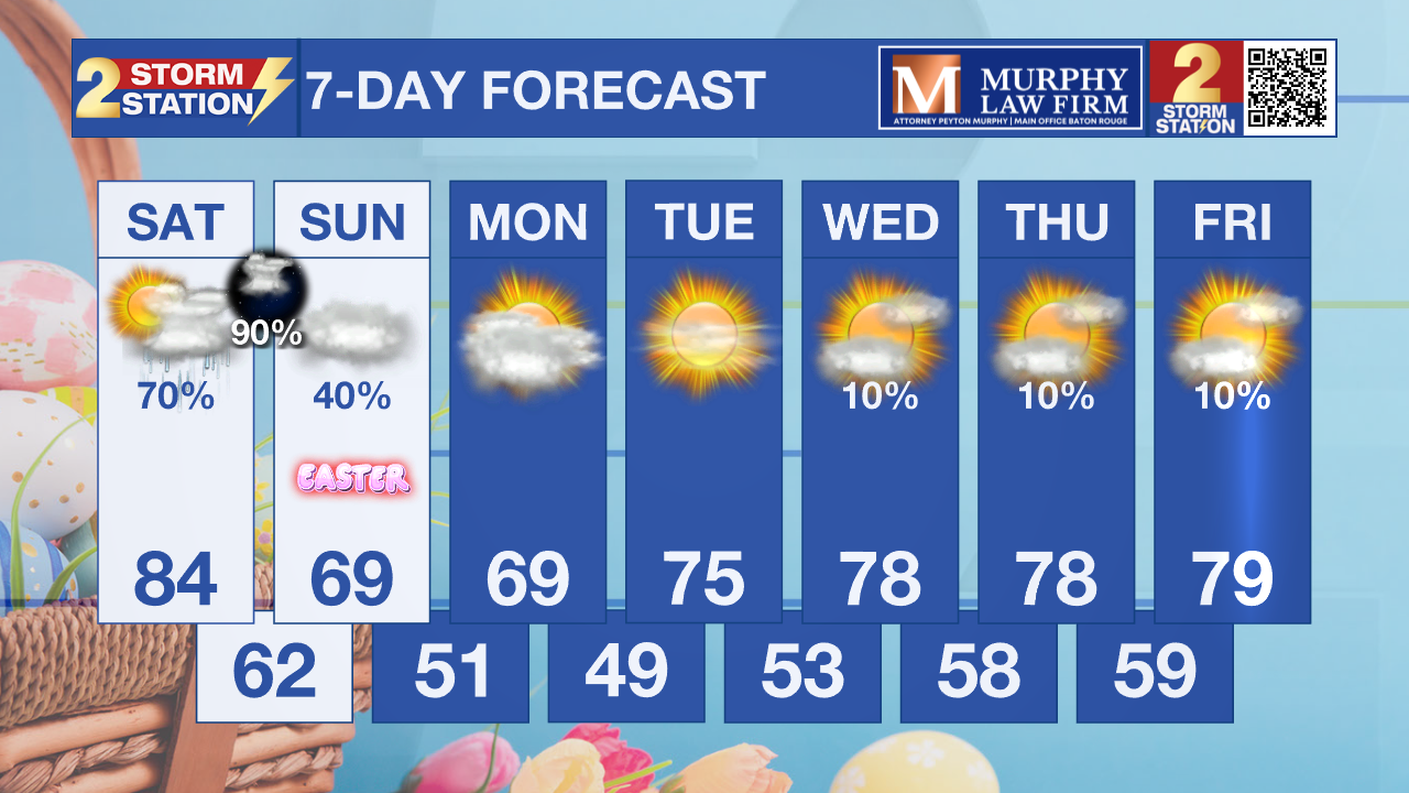
Easter Sunday morning, conditions may still be unsettled depending on how quickly storms clear out overnight. Early-morning egg hunts and sunrise services could be affected by lingering showers, wet ground, or low clouds, especially in areas that see heavier rain Saturday. It won’t be a washout everywhere, but you’ll want a backup plan or at least be ready to dodge a few showers early in the day.
Get the latest 7-day forecast and real-time weather updates HERE.
Watch live news HERE.
– Dave
The Storm Station is here for you, on every platform. Your weather updates can be found on News 2, wbrz.com, and the WBRZ WX App on your Apple or Android device. Follow WBRZ Weather on Facebook and X for even more weather updates while you are on the go.
More News
