

Latest Weather Blog
Sunday AM forecast: Cool, sunny start to Sunday gives way to a warm and pleasant week ahead
Sunny and cool to wrap up the weekend. Chilly mornings return before a midweek warm-up.
Today and Tonight
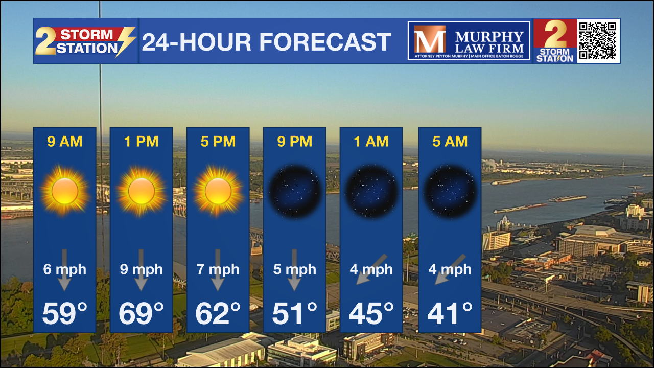
A crisp, sunny start to November continues across southeast Louisiana and southern Mississippi today as cooler, drier air filters in behind last night’s weak system. Northerly winds will keep humidity low and temperatures seasonable, with afternoon highs in the upper 60s to near 70. Skies remain clear tonight with another cool night ahead — lows will dip into the upper 30s and low 40s, with a few colder pockets in our Mississippi counties.
Up Next
Dry weather holds through Tuesday morning as cool air lingers across the region. After that, temperatures begin a quick rebound as winds turn southerly and high pressure strengthens over the Gulf. Highs will climb back into the upper 70s by midweek and likely the low 80s by the weekend. Overnight lows will also warm steadily into the 50s, and with added moisture, morning fog could become more common by late week. Overall, expect a dry, comfortable stretch of fall weather after a chilly start.
Tropics
The Atlantic basin remains quiet this first weekend of November. No tropical cyclone development is expected over the next seven days as the 2025 season winds down.
Trending News
November Normals
Early November in southeast Louisiana usually brings some of the year's most comfortable weather. Humidity drops, mornings are crisp, and afternoons stay pleasantly mild, often in the upper 60s to mid-70s. It’s also one of the driest times of the fall season, with cool fronts still frequent enough to keep things feeling fresh.
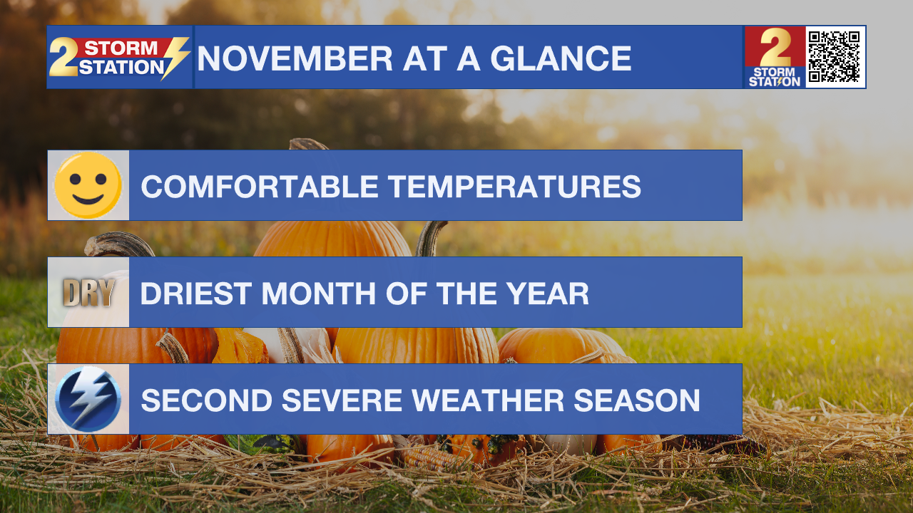
However, November also marks the start of the region’s secondary severe weather season. Those stronger cold fronts from the north clash with lingering Gulf moisture, and southeast Louisiana can see rounds of thunderstorms capable of producing damaging winds, hail, or even isolated tornadoes. While not as active as spring, these late-season systems can still pack a punch, especially when temperatures briefly rebound into the 70s or 80s ahead of a front.
Get the latest 7-day forecast and real-time weather updates HERE.
Watch live news HERE.
– Dave
The Storm Station is here for you, on every platform. Your weather updates can be found on News 2, wbrz.com, and the WBRZ WX App on your Apple or Android device. Follow WBRZ Weather on Facebook and X for even more weather updates while you are on the go.
More News
