

Latest Weather Blog
Sunday AM Forecast: Humidity levels lower, temperatures stay the same
After a summer full of sweltering, sticky air, relief is finally here. While temperatures are not cooling down, lower humidity will deliver a more comfortable feel.
Today & Tonight: Much drier air will settle in today, delivering lots of sunshine, lower humidity, and a more comfortable feel. Temperatures will still climb into the mid-90s, but the heat index may finally stay out of the triple digits. Rain chances will be very low, leaving most areas dry. We will have mainly clear skies overnight, with lows in the lower 70s.
Up Next: Monday keeps the same trend—dry, sunny, and noticeably less humid. By Tuesday, however, front number two will begin approaching. That will pull in a bit more moisture, slightly raising humidity and the chance for a few more afternoon storms. There’s still some uncertainty on its exact timing, but the latest guidance favors a Tuesday night passage. Behind it, another surge of dry air will sweep in for Wednesday and Thursday, once again slashing humidity levels and leaving rain chances very slim. Temperatures won’t budge much, though some spots could dip into the upper 60s at night. As we move toward next weekend, shifting winds will bring humidity and higher rain chances back into play.
The Tropics: Tropical Storm Fernand, which formed yesterday evening, is struggling at the moment. Winds have held steady at 40 mph, barely maintaining its tropical storm status. The max expected intensity has been lowered because of this, with Fernand no longer expected to become a hurricane. It will gradually pick up speed, turning northeast in the next couple of days. By early next week, the storm is expected to weaken as it moves into cooler waters and stronger winds aloft, likely losing its tropical characteristics within 2–3 days. Fernand is no threat to the mainland U.S.
Trending News
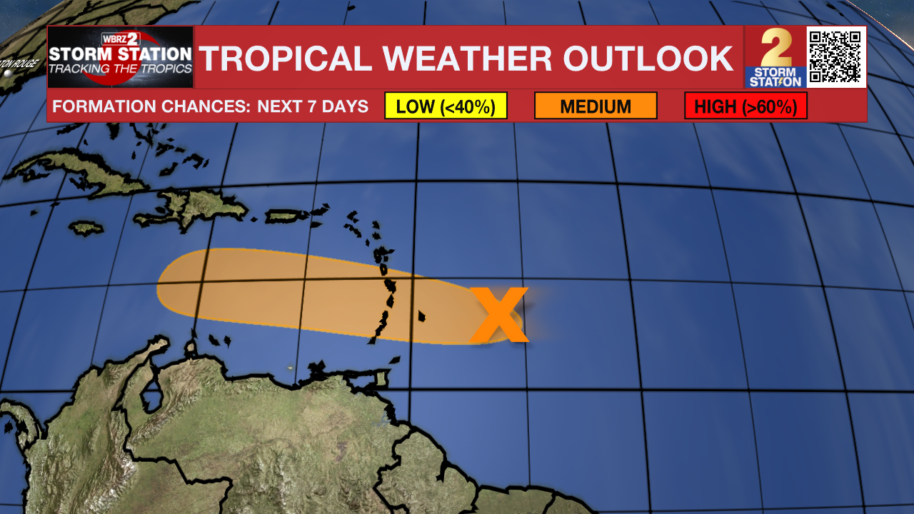
Showers and thunderstorms associated with a tropical wave located about 200 miles east of the Windward Islands have increased since yesterday. However, the wave does not appear to have a surface circulation. This system could still become a tropical depression during the next day or two while it moves quickly westward at about 20 to 25 mph, passing through the Windward and Leeward Islands later today and early Monday. Regardless of development, locally heavy rainfall and gusty winds are likely across portions of the Windward and Leeward Islands today and Monday. The system is expected to reach the central Caribbean Sea on Tuesday, where conditions are forecast to become less favorable for additional development. An Air Force reconnaissance aircraft is scheduled to investigate the system this afternoon, if necessary.
Get the latest 7-day forecast and real-time weather updates HERE.
Watch live news HERE.
– Balin
The Storm Station is here for you, on every platform. Your weather updates can be found on News 2, wbrz.com, and the WBRZ WX App on your Apple or Android device. Follow WBRZ Weather on Facebook and X for even more weather updates while you are on the go.
More News
