

Latest Weather Blog
Sunday PM Forecast: Pleasant start to the week, series of fronts to follow
With a cold front now through the area, the new workweek will kick off with beautiful weather. The fall pattern continues through the rest of the week, with a series of fronts bringing day-to-day changes to the forecast.
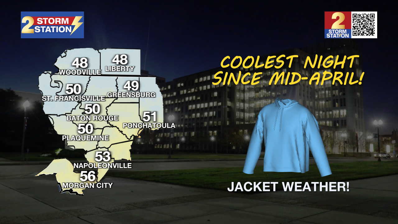
Tonight & Tomorrow: With clear skies and a light northeast wind, the Capital Area will be in for one of the coolest nights since April. Baton Rouge will make a run for 50° around daybreak, with a few neighborhoods slipping into the upper-40s. Near the coast, lows will settle in the mid to upper 50s. Consider taking a light jacket when heading off to work or sending the kids to school. By afternoon, the extra layer won’t be needed. Highs will climb into the lower and middle-80s under full sunshine.
Up Next: The rest of the forecast features several frontal passages. Each day’s weather will have a slightly different look and feel.
Tuesday – It will be a little warmer, with highs returning to the mid-80s and lows to the upper-50s. A returning southeast wind will pump humidity back into the region as well. While not terribly humid, it may feel a touch muggy at times. This change in pattern will not last long. Another cold front will pass through sometime during the afternoon or evening. With it, there might be a few passing storms. These quick-hitting showers will not be significant rainmakers.
Wednesday & Thursday – Behind Tuesday’s front, another blast of cooler and drier air will invade. Expect mainly sunny skies to take over with highs closer to 80°. And by Thursday morning, lows will bottom out in the lower 50s once again.
Friday & The Weekend – With a warm front moving through the area on Friday, expect temperatures and humidity to rise again. The muggy feel will be back over the weekend. Combined with an upper-level disturbance arriving on Saturday, another round of storms enters the forecast. While it’s still too far out for specifics, there might be a few stronger storms in the mix. This will likely be the next weather impact — so pay attention to the forecast, especially as the weekend gets closer. While storm chances appear lower on Sunday, don’t expect much of a change in feel.
Trending News
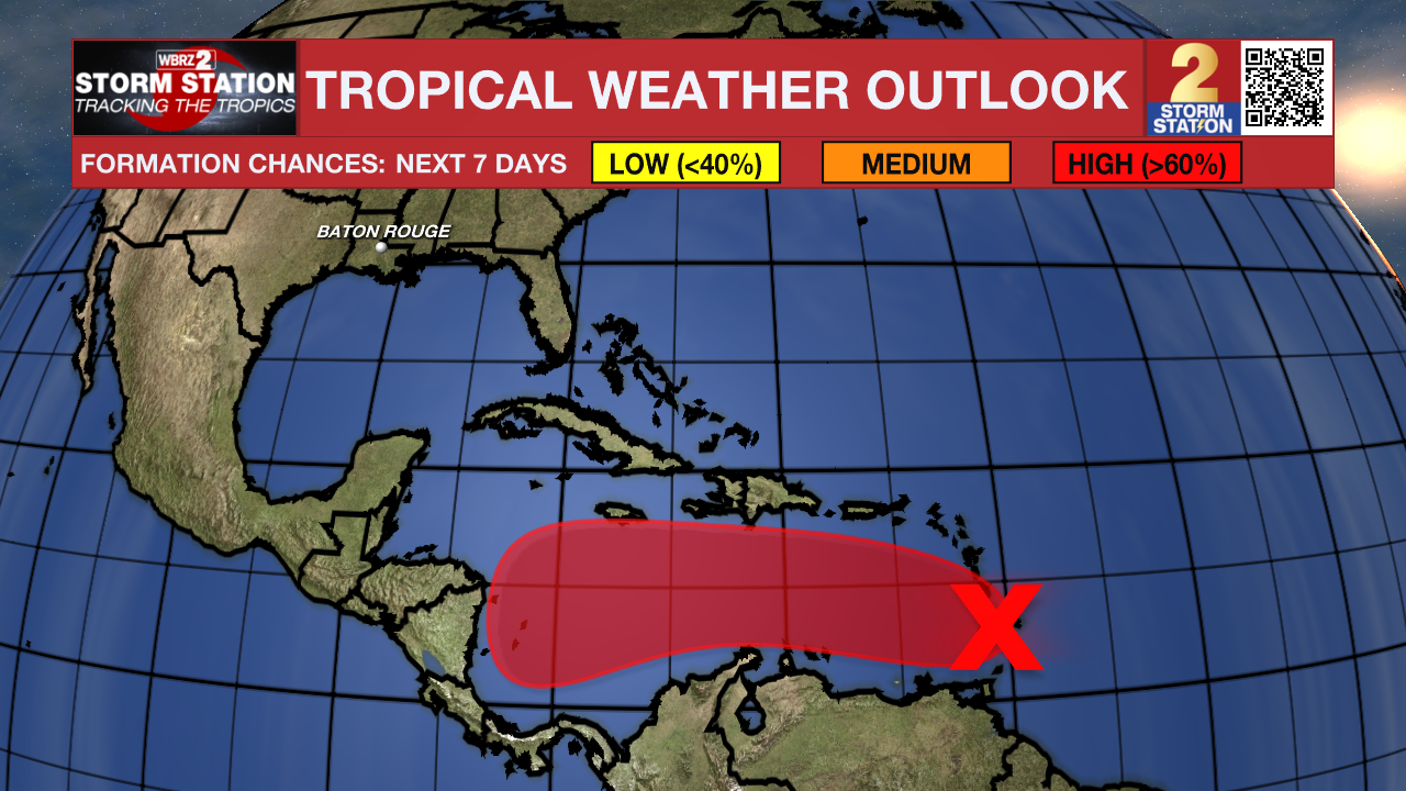
The Tropics: A tropical wave crossing the Windward Islands on Sunday still lacks a closer circulation. However, both satellite and radar imagery reveal signs of organization. This system is moving quickly westward into the Caribbean Sea at 20 to 25 mph, which could limit additional development over the next day or so. However, conditions will become more favorable for tropical development later in the week. A tropical depression is likely to form by mid-to-late week as the system slows down in the Caribbean. The next name up is Melissa.
Get the latest 7-day forecast and real-time weather updates HERE.
Watch live news HERE.
— Meteorologist Malcolm Byron
The Storm Station is here for you, on every platform. Your weather updates can be found on News 2, wbrz.com, and the WBRZ WX App on your Apple or Android device. Follow WBRZ Weather on Facebook and X for even more weather updates while you are on the go.
More News
