

Latest Weather Blog
Thursday AM Forecast: Back to the heat alerts, less afternoon storms
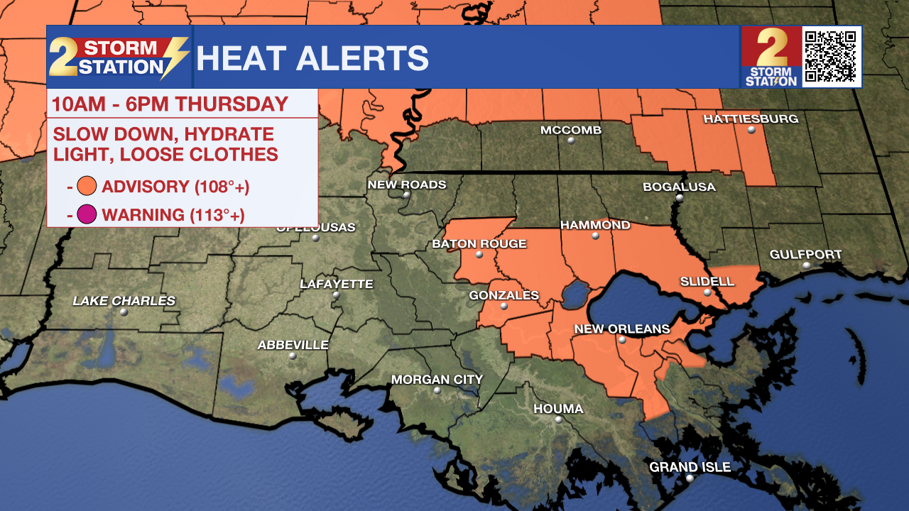
A Heat Advisory has been issued for East Baton Rouge, Livingston, Ascension, Tangipahoa, and St. James parishes. Heat index values up to 111 degrees are expected. Hot temperatures and high humidity may cause heat illnesses. Drink plenty of fluids, stay in an air-conditioned room, stay out of the sun, and check up on relatives and neighbors.
Today & Tonight: High pressure is starting to build in, and that means less afternoon storms, and more heat! Now it will not be completely dry, as isolated storms are still expected. Temperatures will reach into the middle 90s, with feels-like values up to 111 degrees possible. Heat alerts have been issued in some locations because of these conditions. Overnight, skies will clear out with lows in the middle 70s.
Up Next: Storm chances will fade heading into Thursday and Friday, allowing heat to take the driver’s seat. With fewer showers to cool things down, highs will push into the mid-90s Friday through Sunday. Factor in the humidity, and “feels-like” readings could soar into the 106–111° range—enough to warrant the possibility of more heat alerts. A small disturbance aloft arrives Sunday, which may nudge up afternoon storm coverage just a bit. Still, the overall theme will be sweltering heat. The pattern carries into next week with more hot, humid days and a few isolated afternoon downpours.
The Tropics: Erin is slowly but surely gaining strength, as it is now a 50 mph tropical storm. The storm will soon intensify further, likely becoming the first hurricane of the season by late week and possibly the first major hurricane over the weekend. While no watches or warnings have been posted yet, residents of the northern Leeward Islands, the Virgin Islands, Puerto Rico, and the Bahamas should monitor its progress. Long-range guidance suggests a recurve north into the Atlantic Ocean, but it remains unclear exactly when and where that will happen. In any event, a track into the Gulf is not expected.

A broad area of low pressure near the west coast of the Yucatan Peninsula is producing disorganized showers and thunderstorms. The broad low is forecast to emerge off the coast later this morning and move west-northwestward across the southwestern Gulf during the next day or two, where environmental conditions are marginally conducive for further development. The system is forecast to move inland over northeastern Mexico by late Friday, ending its chances of formation.
Trending News
Get the latest 7-day forecast and real-time weather updates HERE.
Watch live news HERE.
— Balin
The Storm Station is here for you, on every platform. Your weather updates can be found on News 2, wbrz.com, and the WBRZ WX App on your Apple or Android device. Follow WBRZ Weather on Facebook and X for even more weather updates while you are on the go.
More News
