

Latest Weather Blog
Thursday AM Forecast: Temperatures increase before major front passage
Temperatures, and even humidity will steadily increase as we move into the weekend. Highs will top out in the 80s on Saturday, but we will likely not leave the 50s by Monday after a significant front passage. The first freeze of the season is possible Tuesday morning.
Today & Tonight: After some areas of dense fog, skies will turn mostly sunny for the rest of the day. Highs will top out in the upper 70s, with some reaching the 80s. Overall, the weather will stay pretty quiet so outside activities are good to go! Overnight, lows will only bottom out near 63 degrees, with fog development not as likely.
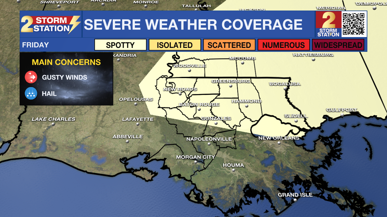
Up Next: As moisture values increase, and a weak front approaches, isolated showers and storms will be possible Friday. Although the best rain chance will be in the afternoon, a few showers cannot be ruled out in the morning. A few storms have the opportunity to be on the stronger side, but the threat of severe weather is low. Any storm that does become severe could have gusty winds and hail. For the Friday Night Blitz, rain chances will be on the decline in the evening. Temperatures will sit in the lower 70s during these games, so long-sleeves are not needed. Rain chances decrease Saturday, but warm and muggy conditions are expected.

Trending News
A powerful cold front will sweep through the area early Sunday, bringing little more than a brief shower. The bigger change will be how it feels behind the front—northwest winds of 10–20 mph will usher in much cooler air, keeping afternoon highs confined to the low 70s.
The real chill sets in Monday. Morning lows in the upper 30s will give way to a day that does not leave the 50s. Even colder air arrives Monday night into Tuesday morning, when clear skies and light winds will let temperatures drop into the mid to lower 30s. Frost could develop as far south as I-10, with a freeze likely north and east of Baton Rouge, especially near I-55 and across southwest Mississippi.
The Tropics: For the Gulf, Caribbean, and Atlantic, all is quiet. No new tropical development is expected over the next seven days.
Get the latest 7-day forecast and real-time weather updates HERE.
Watch live news HERE.
– Balin
The Storm Station is here for you, on every platform. Your weather updates can be found on News 2, wbrz.com, and the WBRZ WX App on your Apple or Android device. Follow WBRZ Weather on Facebook and X for even more weather updates while you are on the go.
More News
