

Latest Weather Blog
Thursday PM Forecast: Tropical moisture moving in, watching commutes and weekend football
Deep tropical moisture has its sights set on the Capital Area. While the rain is much needed, the timing could be inconvenient for daily commutes and a busy football weekend.
Tonight & Tomorrow: While late-day showers and thunderstorms might linger into the evening, they will gradually taper with time. Skies will clear out overnight; however, a few passing clouds will begin arriving from the east by daybreak. Clouds will increase throughout Friday as tropical moisture surges into the Capital Area. This will eventually kick out numerous showers and thunderstorms, especially into the afternoon. Per usual, any storms could briefly cause heavy rain and frequent lightning. Should those overlap with the commute and after-school activities, be prepared for possible delays and cancellations. Look for a high in the upper 80s to low 90s.

Use the slider to advance through the next 24 hours of Futurecast
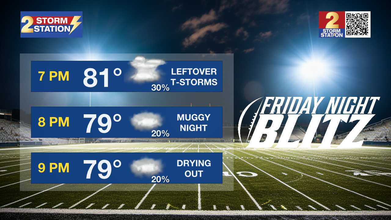
Friday Night Blitz: As high school football kicks off Friday night, definitely keep a poncho handy. A few leftover showers remain possible into the evening, though they should taper off after dark. Still, don't rule out a lightning delay or two.
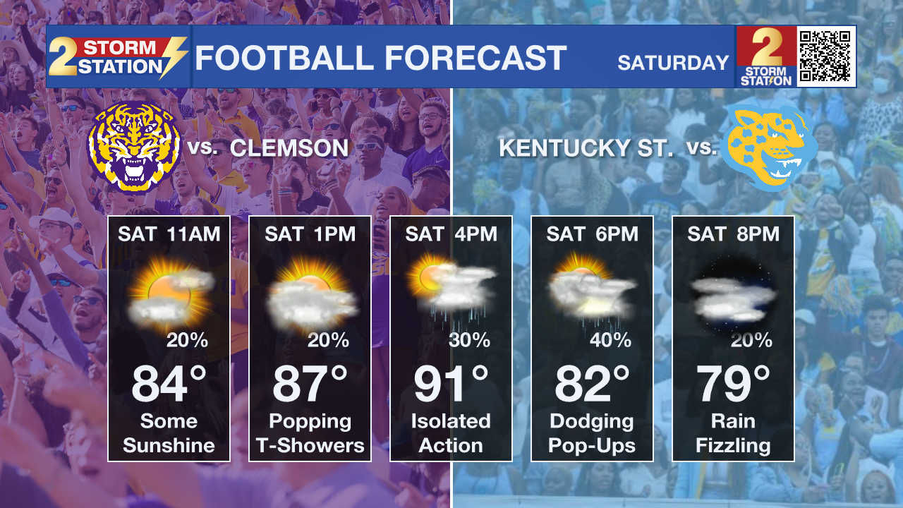
Tigers/Jags Showdown: With LSU and Southern set to host their first football matches and tailgates of the season, the Capital City will be buzzing with activity on Saturday. While the weather won’t venture into washout territory, a few disruptions are possible. Intermittent downpours are possible as early as the morning, but will become more likely during the afternoon as temperatures warm. Heavy rain and frequent lightning will accompany a few storm cells — a sure threat to anyone outside.
Trending News
Be ready to take shelter from lightning in an enclosed structure or vehicle (with windows rolled up) at a moment’s notice. Isolated activity might linger after kickoff, but storms will become less of an issue into the night. Daytime highs will reach the low 90s before the rain sets in, dropping into the low 80s by kickoff.

Up Next: A ridge of high pressure will build over the region early next week, steadily driving down rain chances from starting Sunday. Meanwhile, typical late-summer heat returns, with highs in the mid-90s and overnight lows in the mid-70s.
Get the latest 7-day forecast and real-time weather updates HERE.
Watch live news HERE.
The Tropics: With Edouard becoming post-tropical on Thursday morning, the Atlantic is returning to its slumber. No tropical development is expected over the next seven days across the Gulf, Caribbean, and Atlantic.
— Meteorologist Malcolm Byron
The Storm Station is here for you, on every platform. Your weather updates can be found on News 2, wbrz.com, and the WBRZ WX App on your Apple or Android device. Follow WBRZ Weather on Facebook and X for even more weather updates while you are on the go.
More News

