

Latest Weather Blog
Heat Advisory through Wednesday, Flood Watch issued ahead of late week heavy rain potential
A HEAT ADVISORY will be in effect from 10 a.m. - 7 p.m. Tuesday and Wednesday for many around the Capital Area, including East Baton Rouge, West Baton Rouge, Ascension, Assumption, Iberville, East Feliciana, Livingston, Pointe Coupee, St. Helena, St. James, Tangipahoa, and West Feliciana Parishes as well as, Amite and Wilkinson Counties. Expect feels-like temperatures as hot as the 105-110° range for several hours during the afternoon. Drink plenty of fluids, wear light clothing, and take breaks during the hottest parts of the day.
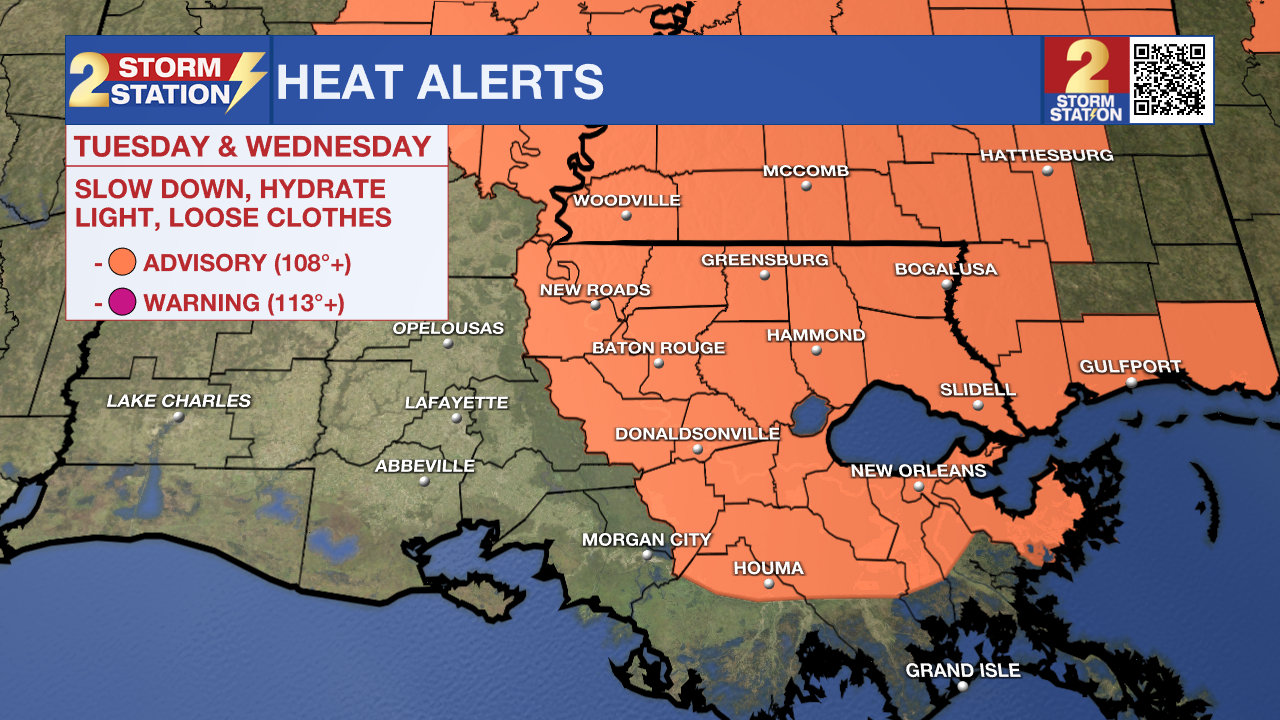
Today & Wednesday: Tuesday will be hot and humid with highs in the low to mid-90s and feels-like temps up to 110°. Only spotty showers (20% coverage) are expected. Overnight lows dip into the 70s under clearing skies. On Wednesday, highs stay near 94° with sunshine early, but clouds and isolated storms build in by afternoon, with rain chances increasing into the overnight hours.
The National Weather Service has issued a ***FLOOD WATCH*** for East Baton Rouge, West Baton Rouge, Ascension, Assumption, Iberville, East Feliciana, Livingston, Pointe Coupee, St. Helena, St. James, Tangipahoa, and West Feliciana Parishes. It will go into effect Wednesday afternoon and last through Friday night. A FLOOD WATCH means conditions may develop that lead to flash flooding. Flash flooding is a very dangerous situation. Be on the lookout for threatening weather conditions and listen for later statements and possible warnings. For more on flooding safety, CLICK HERE.
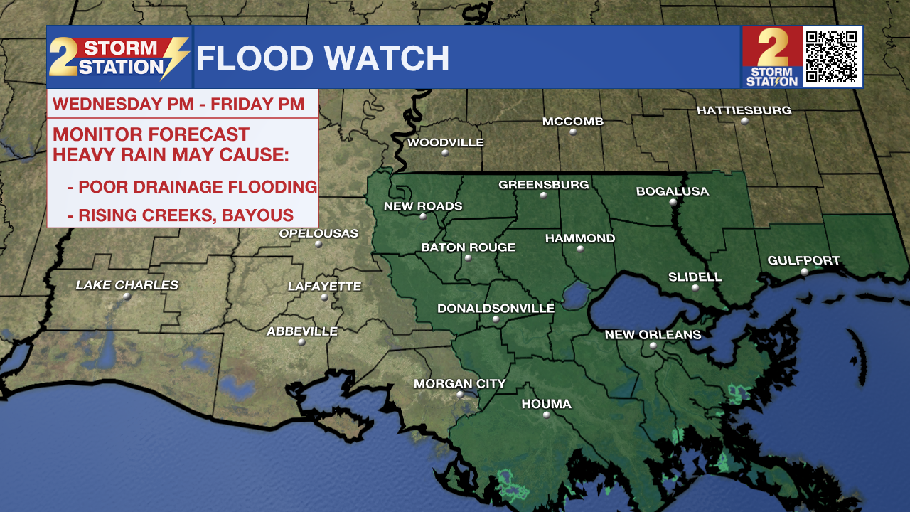
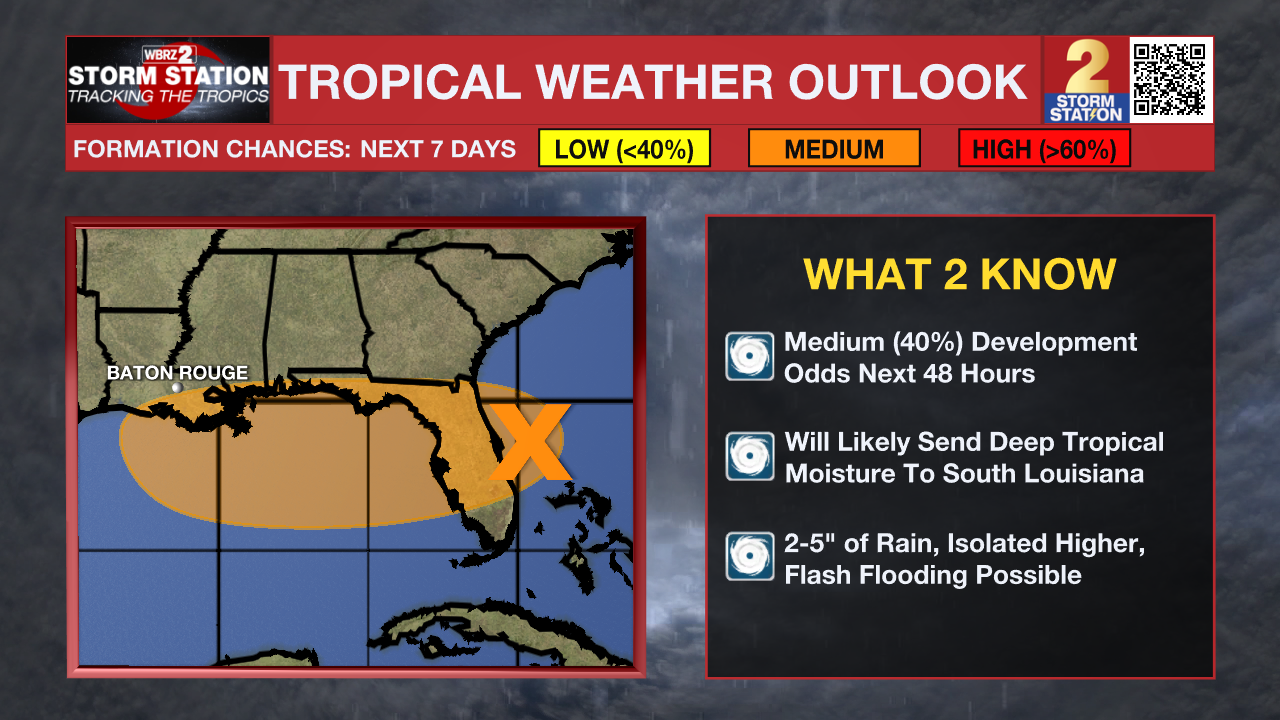
Late Week and Weekend: The weather will take on a tropical influence by the end of the week as a tropical wave brings extreme moisture amounts to south Louisiana. This will lead to several days in a row of very high rain coverage beginning late Wednesday through the weekend. Rainfall totals of 2–5 inches are likely, with locally higher amounts possible, especially near the coast. Isolated flash flooding cannot be ruled out due to the chance of heavy rains over three days. Details are still coming together, so stay tuned for updates. More on the system's potential development is outlined below.
Trending News
The Tropics: A low-pressure system near the east coast of Florida is becoming more organized, though storms remain scattered early Tuesday. It’s expected to move across Florida and into the northeastern Gulf by Wednesday morning, where conditions could allow it to develop into a tropical depression. At this time, there is a medium (40%) chance of Tropical development over the next 48 hours with this system. Regardless of development, heavy rain may lead to localized flash flooding in parts of Florida and along the north-central Gulf Coast later this week.
Get the latest 7-day forecast and real-time weather updates HERE.
Watch live news HERE.
– Emma Kate C.
The Storm Station is here for you, on every platform. Your weather updates can be found on News 2, wbrz.com, and the WBRZ WX App on your Apple or Android device. Follow WBRZ Weather on Facebook and X for even more weather updates while you are on the go.
More News
