

Latest Weather Blog
Tuesday PM Forecast: Reinforcing the dry air before humidity creeps back
The Capital Area will continue to catch a break from the humidity for another day or so. But it won’t take too long for humidity to start easing back into the area again.
Tonight & Tomorrow: Drier air will be reinforced overnight. The lesser humidity will allow morning lows to drop further. Under a mostly clear sky, Baton Rouge could dip into the upper 60s for the first time since early June. Even coastal sections could see lows near 70°. Humidity will remain in check for just about everyone on Wednesday. That will make the forecast high in the low 90s feel more comfortable. Another passing disturbance could ring out a spotty shower or two. But in a moisture-starved environment, they will be few and far between.
Up Next: Humidity will creep back in through the remainder of the workweek, though what’s felt will depend on location and time of day. The steamiest conditions will be more prevalent south of I-10 during the day, whereas areas north could dip into a slightly more “comfortable” realm at times. Meanwhile, most areas will be on the humid side at night. Overnight lows will climb in response. Daytime highs will follow a similar trend, reaching the mid-90s by Friday.
Several “ripples” in the atmosphere will arrive over the weekend. Acting on the additional humidity, they could excite more showers and storms. It would be wise to keep an eye on the sky — especially with LSU and Southern University kicking off on Saturday. There were signs in recent days of another big push of dry air by late weekend. That signal now appears to be declining. If anything, the forecast is trending in the wetter direction. Check back later in the week to see if conditions trend even soggier.
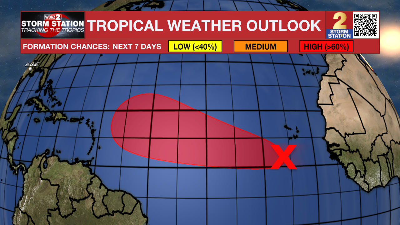
The Tropics: A tropical wave in the far eastern tropical Atlantic is producing a disorganized cluster of showers and thunderstorms. Conditions appear favorable for the gradual development of this system over the next several days. A tropical depression appears likely to form late this week or this weekend. While initially moving slowly westward, the system will accelerate west to west-northwestward into early next week as the system organizes. The next name up is Gabrielle.
Trending News
Get the latest 7-day forecast and real-time weather updates HERE.
Watch live news HERE.
— Meteorologist Malcolm Byron
The Storm Station is here for you, on every platform. Your weather updates can be found on News 2, wbrz.com, and the WBRZ WX App on your Apple or Android device. Follow WBRZ Weather on Facebook and X for even more weather updates while you are on the go.
More News
