

Latest Weather Blog
Tuesday PM Forecast: tracking a front with rain, storms and big humidity changes
After several hot, humid, summer-like days, our weather pattern is about to change noticeably. A cold front will bring a good chance of rain and storms through the middle of the week, followed by much lower humidity.
Tonight & Tomorrow: Isolated showers and thunderstorms will ease this evening, followed by mostly clear skies. It will be a muggy night with lows in the mid-70s. Early sun will help push highs into the low 90s on Wednesday. However, clouds will pile up quickly, with numerous showers and thunderstorms firing by afternoon. Some spots could see heavy rain in a short time, which is welcome news for our parched lawns and gardens. But it can lead to some minor poor-drainage flooding from time to time. Take an umbrella for after-school pickups or the evening commute. Should any storms flare up into something stronger, gusty winds would be the main concern.
Up Next: There is some uncertainty regarding the exact time that showers and thunderstorms shut down, and it will all depend on the position of the front and any ongoing showers and thunderstorms on Thursday morning. As of now, scattered showers and thunderstorms remain in the forecast because the front is expected to move through very slowly. This should produce enough moisture and lift in the region to support more activity. However, if the front progresses south more quickly, or showers and thunderstorms persist at the coast, it will be harder for new development to occur inland. The day could end up drier in that scenario. Ample cloud cover and the advancing air mass from the northwest should hold highs in the mid-80s.
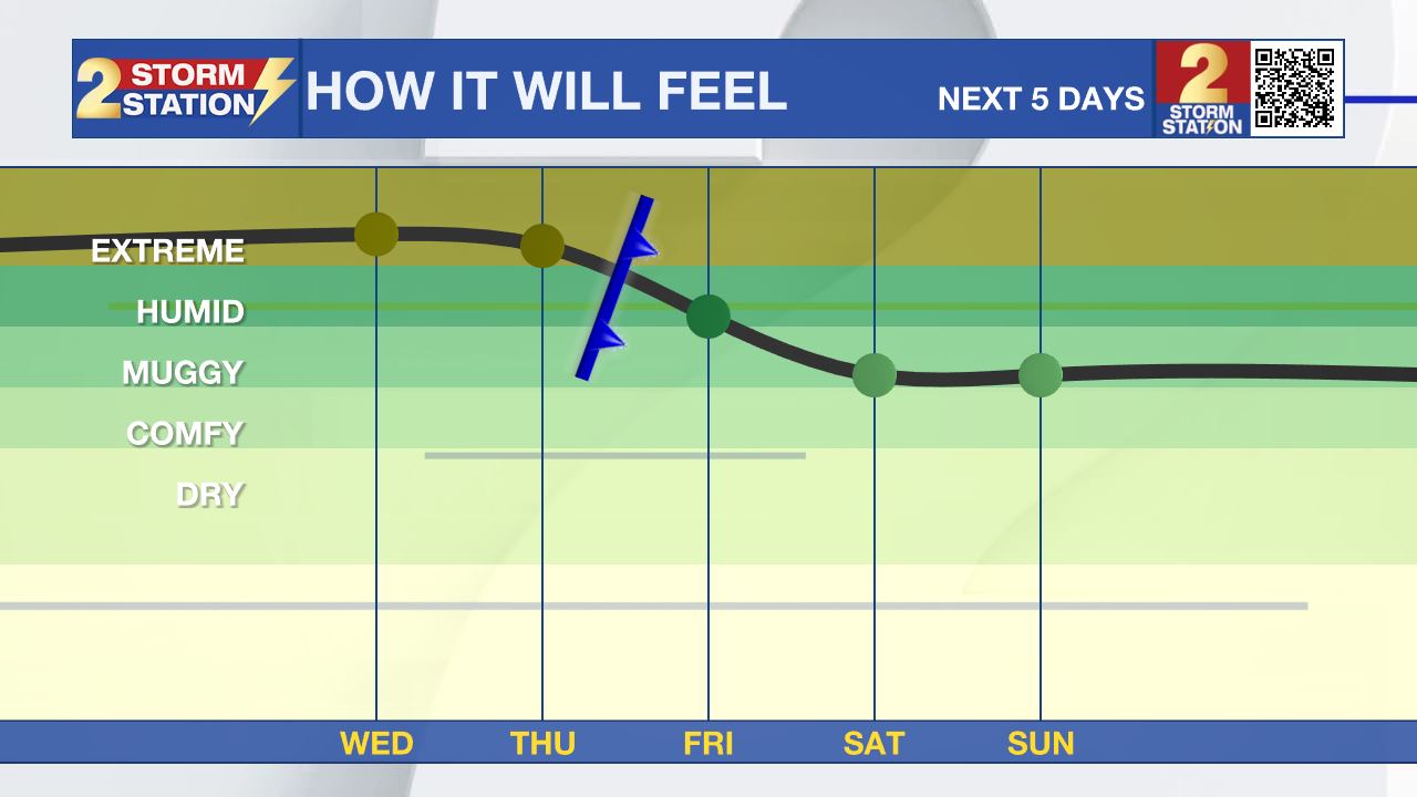
The front will finally push through on Friday, leaving behind lower humidity and more comfortable mornings. While a leftover shower can’t be ruled out near the coast and early, most of the day will be drier with highs in the mid-80s. Saturday and Sunday will be mostly clear with mornings in the mid-60s and afternoons in the upper 80s. It’s the type of early-fall weather many have been waiting for.
Trending News
The more comfortable stretch should continue into early next week, with sunshine mixing with a few clouds and highs close to 90 degrees. Importantly, the lower humidity will stick around, keeping mornings and evenings pleasant.

The Tropics: Hurricane Gabrielle, a powerful Category 4 storm with winds near 130 mph, is racing east-northeast and is expected to reach the Azores Thursday into Friday. While some weakening is expected, it will likely still be a hurricane when it passes through, bringing the risk of damaging winds, heavy rain, coastal flooding, and dangerous surf. A Hurricane Watch is in effect for all of the Azores.
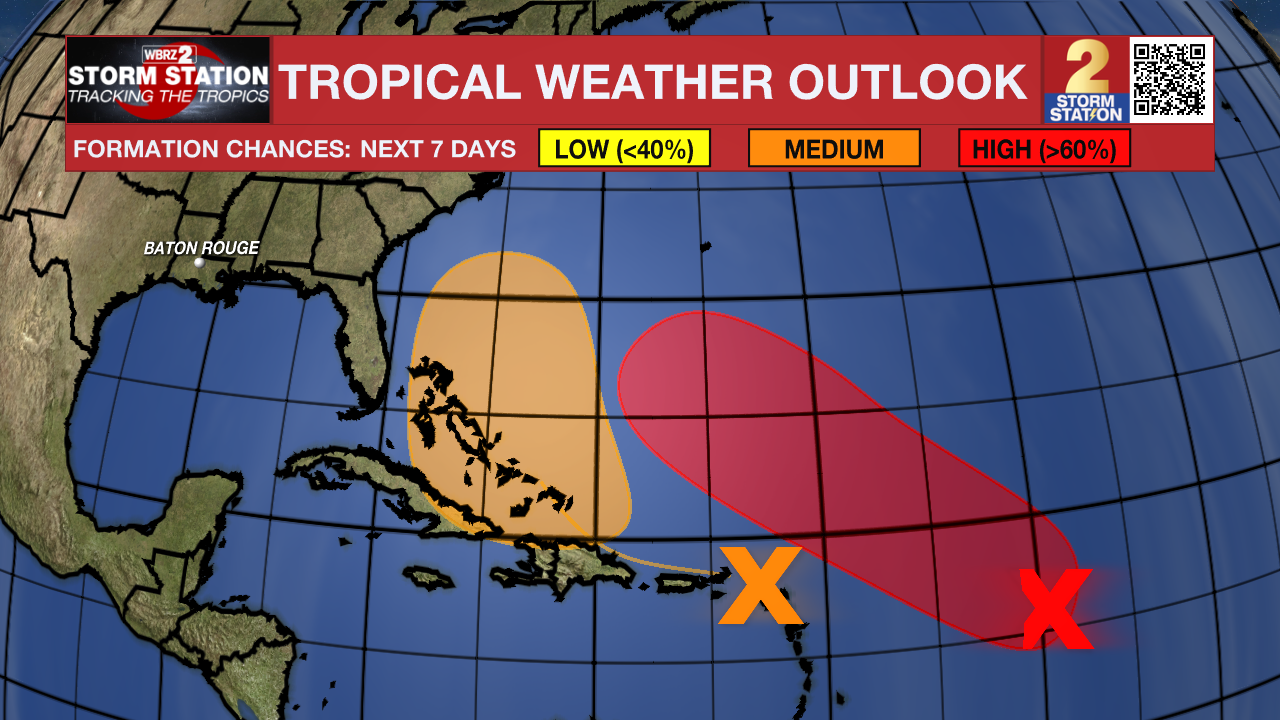
A tropical wave in the central Atlantic, about 900 miles east of the Lesser Antilles, is becoming better organized and is likely to develop into a tropical depression within the next couple of days. Another system is spreading heavy rain and gusty winds across the Lesser Antilles and could develop later this week near the Bahamas.
Get the latest 7-day forecast and real-time weather updates HERE.
Watch live news HERE.
– Josh
The Storm Station is here for you, on every platform. Your weather updates can be found on News 2, wbrz.com, and the WBRZ WX App on your Apple or Android device. Follow WBRZ Weather on Facebook and X for even more weather updates while you are on the go.
More News
