

Latest Weather Blog
Tuesday PM Forecast: warming trend halted by Sunday, coldest air so far this season in sight
A warming trend will continue through the remainder of this week with high temperatures eclipsing the 80s on several afternoons. Some morning fog will be possible amidst the warmup ahead of the next chance for rain and a strong cold front.
Through Saturday: warming with morning fog
Friday: spotty shower or thunderstorm
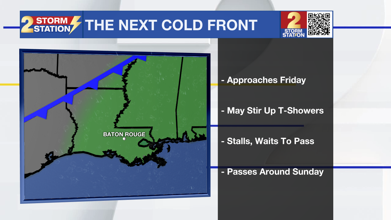
Sunday: breezy with a strong cold front
Monday & Tuesday: coldest air so far this season, frost possible
Tonight & Tomorrow: Clear skies and light winds will set the stage for optimal cooling tonight as well as favorable conditions for fog formation. As lows settle into the upper 40s and low 50s, incoming moisture from the south could lead to the development of fog and reduced visibility for the morning commute. Any fog will dissipate to mostly sunny skies on Wednesday afternoon, and highs will climb to the upper 70s.
Trending News
Up Next: Thursday, Friday, and Saturday will continue the trend of warmer afternoons and potentially foggy mornings. Thursday will have a little better chance of fog than Friday and Saturday, with lows in the 50s versus the 60s on the latter two mornings. While each of the three afternoons will reach the 80s, Friday and Saturday will feel a little more muggy than Thursday. Spotty showers and thunderstorms may even pop on Friday, but rain coverage will be low overall, around 20%. Keep that in mind if heading out to the high school football games.
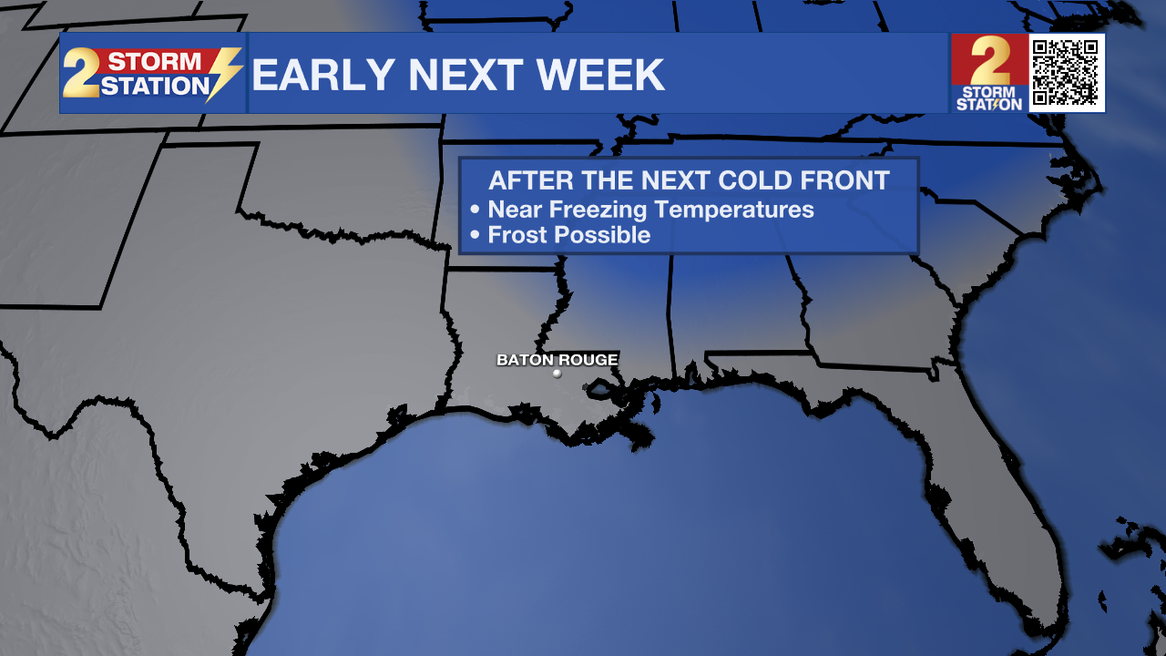
A very strong cold front will journey through the region on Sunday. We will notice a difference immediately, as winds pick up out of the northwest at 10-20mph, and high temperatures stop in the 70s. A big plunge in temperatures will follow on Monday. After starting off in the 40s, temperatures will struggle to reach the 60s. The coldest air so far this season will spill into place, and this will be felt on Tuesday morning. As winds calm, clear skies will allow temperatures to fall back into the 30s with frost possible as far south as I-10 and a freeze possible north and east of Baton Rouge—especially near I-55 and in southwest Mississippi.
The Tropics: For the Gulf, Caribbean, and Atlantic, all is quiet. No new tropical development is expected over the next seven days.
Get the latest 7-day forecast and real-time weather updates HERE.
Watch live news HERE.
– Josh
The Storm Station is here for you, on every platform. Your weather updates can be found on News 2, wbrz.com, and the WBRZ WX App on your Apple or Android device. Follow WBRZ Weather on Facebook and X for even more weather updates while you are on the go.
More News
