

Latest Weather Blog
Understanding drought categories as the bayou becomes thirstier
Louisiana is no stranger to water; it quite literally defines the state’s geography and way of life. So, when rain dries up over a prolonged period, the landscape shifts rapidly. It's happening across the state as significant rain continues to be scarce.
Drought is more than just a lack of rain, but rather a natural hazard that ripples through the environment, affecting everything from air quality to water safety to prices at the grocery store.
Developed in 1999, the U.S. Drought Monitor provides a comprehensive overview of drought conditions across the nation. It’s a multi-agency collaboration between the National Drought Mitigation Center, the National Oceanic and Atmospheric Administration, and the Department of Agriculture. Updates are distributed every Thursday, mapping out drought-stricken areas.
While precipitation plays a major role in each update, many other data sources are considered, such as streamflow, reservoir levels, temperature, evaporation, soil moisture, and vegetation health. These indicators, along with field observations and local insights from over 450 experts, go into the map’s creation.
The U.S. Drought Monitor is made up of five categories that describe how dry the soil is and attempt to quantify its impact. Historically speaking, Louisiana has experienced the following impacts at each level:
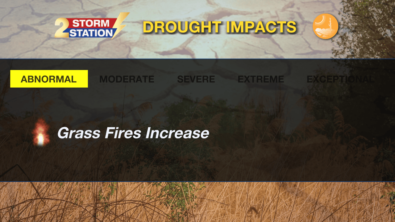
Abnormally Dry – This isn’t a full drought yet, but it’s a sign of where things are going with continued dry conditions. Grass begins turning brittle, and the number of grass fires tends to increase on dry and breezy afternoons.
Trending News
Moderate Drought – At this stage, farmers begin planting fewer crops to avoid losses. The overall fire risk increases further, and local officials begin closely monitoring burn conditions.
Severe Drought – Drought starts showing more visible signs at this stage. The ground begins to crack as the soil dries out. Grass stops growing, the grazing forage disappears, and trees show signs of distress. Local creek and bayou levels also start to run low.
Extreme Drought – A serious drought that threatens all industries that allow Louisiana to thrive. It is at this stage that the crawfish population decreases significantly as their habitats dry out. Rice becomes too expensive to maintain, and soybean yields plummet. As river levels drop, saltwater from the Gulf pushes further inland, making the river too salty for irrigation in the bayou parishes. Local officials begin issuing voluntary water restrictions in addition to bans on burning and fireworks.
Exceptional Drought – The highest and worst drought classification. Louisiana experienced this level of drought in 2023. Voluntary water restrictions tend to become mandatory at this stage. Pasture and crop losses are no longer localized, but rather show up everywhere. The fishing industry becomes heavily compromised. Mosquito numbers also drop with fewer pockets of standing water for them to breed in.
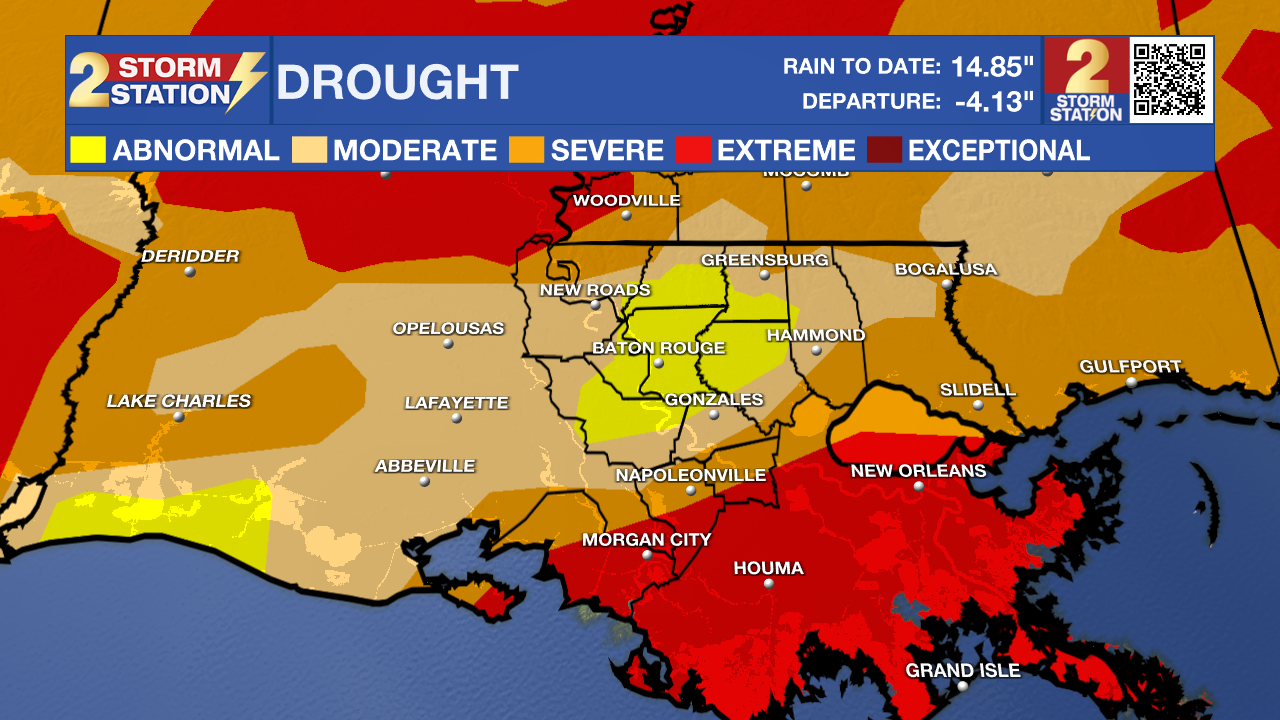
The latest drought outlook reveals a quick ramp-up into severe drought just to the north and south of the Metro Baton Rouge area. The abnormally dry area highlighted in yellow continues to get smaller as moderate drought conditions take over.
Since drought tends to be a slow-moving hazard, tracking drought conditions from week to week provides valuable insight to help mitigate economic losses and make smarter policy decisions. Damages from drought can be as substantial as those from hurricanes, tornadoes, flooding, and other natural disasters.
While the Drought Monitor does not trigger political actions in and of itself, many agencies utilize it. For instance, the USDA uses the Drought Monitor to trigger disaster declarations and eligibility for low-interest loans. The IRS uses it for a tax deferral on forced livestock sales due to drought. On the state and local level, it’s often used as a tool to declare burn bans and water emergencies.
The Storm Station is here for you, on every platform. Your weather updates can be found on News 2, wbrz.com, and the WBRZ WX App on your Apple or Android device. Follow WBRZ Weather on Facebook and X for even more weather updates while you are on the go.
More News
