

Latest Weather Blog
Monday PM Forecast: another extremely cold night, no major warming ahead
There is no sign of the cold letting up in a major way. After a weak attempt at warming, a reinforcing cold front will come through later this week.
An EXTREME COLD WARNING will remain in effect until noon Tuesday for all of southeast Louisiana and southwest Mississippi. Dangerously cold wind chills as low as 10°F are expected. Frostbite and hypothermia will occur if unprotected skin is exposed to these temperatures. An extended period of freezing temperatures could cause ruptured water pipes.
HOW WIND CHILL WORKS - INSIDE THE WEATHER WITH WBRZ CHIEF METEOROLOGIST, DR. JOSH EACHUS
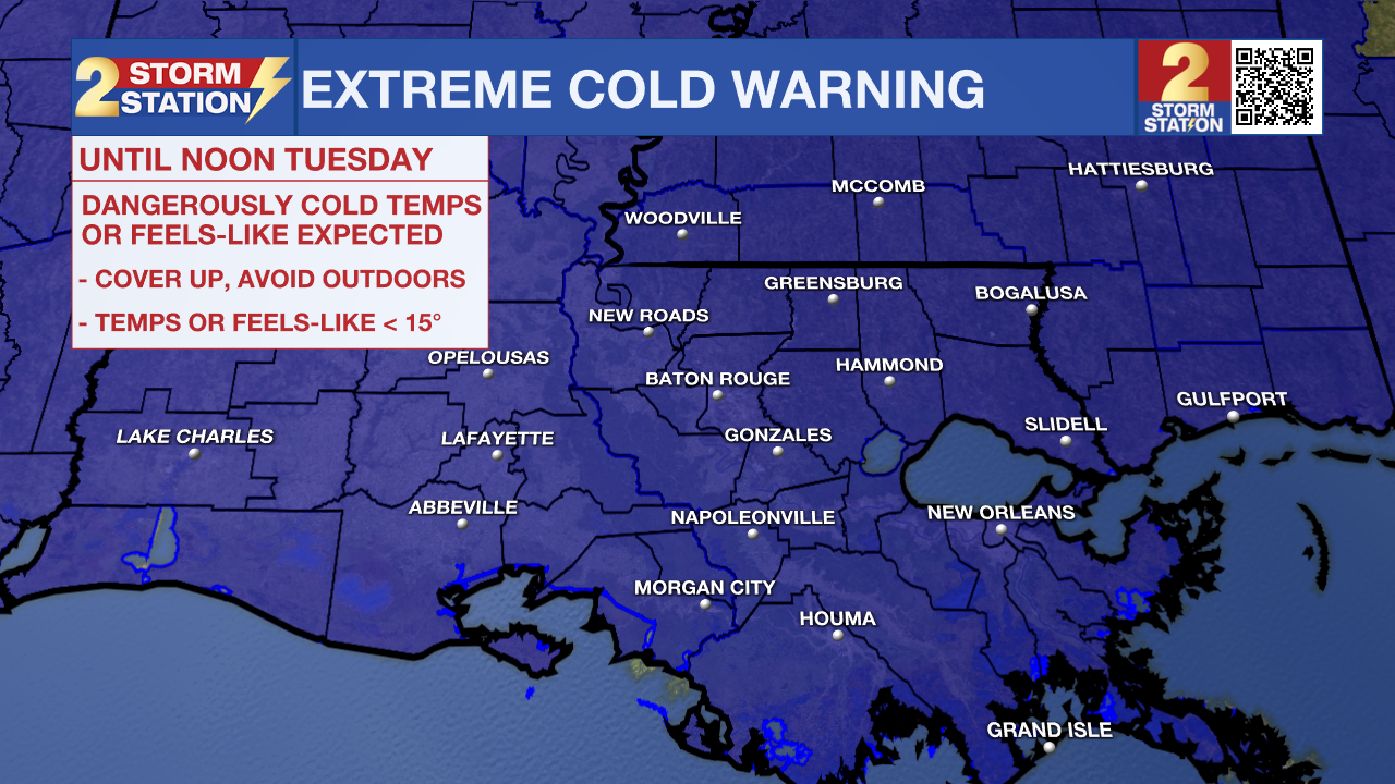
Dress in layers, including a hat, face mask, and gloves if you must go outside. To prevent water pipes from freezing, wrap or drain them or allow them to drip slowly. Keep pets indoors as much as possible. Make sure outdoor animals have a warm, dry shelter, food, and unfrozen water. Make frequent checks on older family, friends, and neighbors. Ensure portable heaters are used correctly. Do not use generators or grills inside. If you do not have heat in your home or lack shelter, you can call 211 for assistance locating appropriate shelter from the cold. Use caution while traveling outside. Wear appropriate clothing, a hat, and gloves.
Trending News
.png)
Tonight & Tomorrow: Under clear skies, another bitterly cold night is ahead. Lows will sink all the way into the upper teens along and north of I-12, with lower 20s elsewhere. Fortunately, the winds will relax compared to the previous 24 hours, and so feels-like temperatures, or wind chills, will not be much lower. Relatively speaking, a bit of a warm-up will begin on Tuesday. With ample sunshine, high temperatures will make it into the mid 40s.
Up Next: The minor warming trend will continue through midweek. After starting in the 20s, Wednesday and Thursday will make it into the low 50s by afternoon. You’ll see plenty of sun on Wednesday, with clouds starting to build up by Thursday, ahead of our next weather maker.
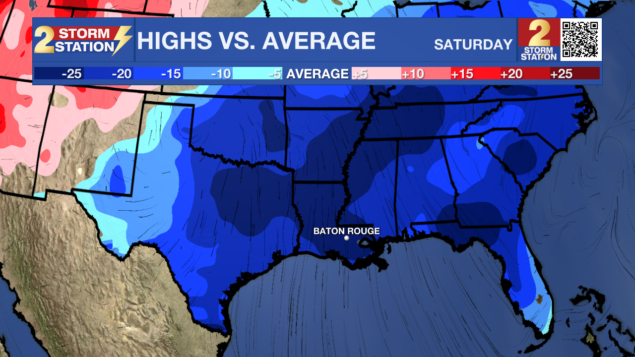
A second strong cold front is scheduled to push through the area on Friday. As of now, this system looks like it will bring clouds and a slight chance of passing showers, followed by another plunge in temperatures. Highs will drop back into the 40s for Friday and the 30s Saturday, with overnight lows tumbling back into the 20s for the weekend. Highs will return to the 50s by Monday, with sunshine and dry conditions remaining.
Get the latest 7-day forecast and real-time weather updates HERE.
Watch live news HERE.
– Josh
The Storm Station is here for you, on every platform. Your weather updates can be found on News 2, wbrz.com, and the WBRZ WX App on your Apple or Android device. Follow WBRZ Weather on Facebook and X for even more weather updates while you are on the go.
More News
