

Latest Weather Blog
Wednesday AM Forecast: Back into the 80s before long, next front arrives over weekend
Temperatures will get back into the 80s by Thursday and stay that way through the first half of the weekend. A strong cold front will stop the trend, and send our temperatures tumbling.
Today & Tonight: Clouds have been very stubborn to leave the last few days, and today looks pretty similar. Expect mostly cloudy conditions all day long, with only a few peaks of sunshine later in the day. Highs will get warm, into the upper 70s. Overnight, clouds will stick around, keeping lows to the mid-60s. Patchy areas of fog will be possible.

Up Next: The warming trend will only continue through the end of the week. Highs will get into the 80s Thursday, and stay well above average through Saturday. At the same time, showers will start to be possible as moisture levels rise. Only expect a few showers Thursday and Friday, with slightly better chances during the first half of the weekend. This is when a cold front will roll through, possibly even bringing a few storms. Temperatures will tumble after it passes.
Trending News
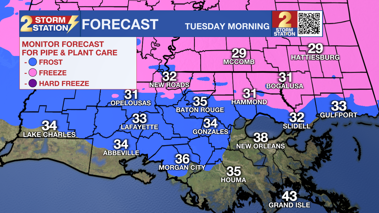
Although its been a while, cold air will return early next week. Highs will top out in the 60s for several days in a row, with lows in the 30s. Areas north of I-12 will have a chance to see freezing temperatures, especially on Tuesday morning. If you have sensitive plants, they may need to be covered or brought inside before early next week.
Get the latest 7-day forecast and real-time weather updates HERE.
Watch live news HERE.
— Balin
The Storm Station is here for you, on every platform. Your weather updates can be found on News 2, wbrz.com, and the WBRZ WX App on your Apple or Android device. Follow WBRZ Weather on Facebook and X for even more weather updates while you are on the go.
More News
