

Latest Weather Blog
Wednesday AM Forecast: Front nearing closer, stormy afternoon in store
A front is nearing closer, and will first cause numerous showers and storms this afternoon and evening. After it passes Thursday, expect some great weather conditions this weekend!
Today & Tonight: An active weather day is in store for southeast Louisiana. As a cold front gets closer, atmospheric moisture values will continuously rise. This will eventually turn into numerous storms this afternoon and evening. Gusty winds, downpours, and frequent lightning will be possible. The evening commute will be affected, so be prepared for slower than normal traffic. Overnight, we will not completely clear out as the front will still be approaching. Scattered showers and storms will be the result, some of which could affect the Thursday morning commute. Lows will be near 72 degrees.
Up Next: There remains some uncertainty on Thursday, as the exact timing of the front passage is still in question. An earlier passage will lead to storms shutting off early, but if it's delayed, storms could last into the afternoon. Post-front conditions will arrive on Friday. Northerly winds will usher in drier and cooler air. Highs will top out in the mid-80s under mostly sunny skies. Great weather will extend into the weekend, with no chance of rain. Highs will stay in the 80s, with lows in the mid-60s. These conditions will last into next week!
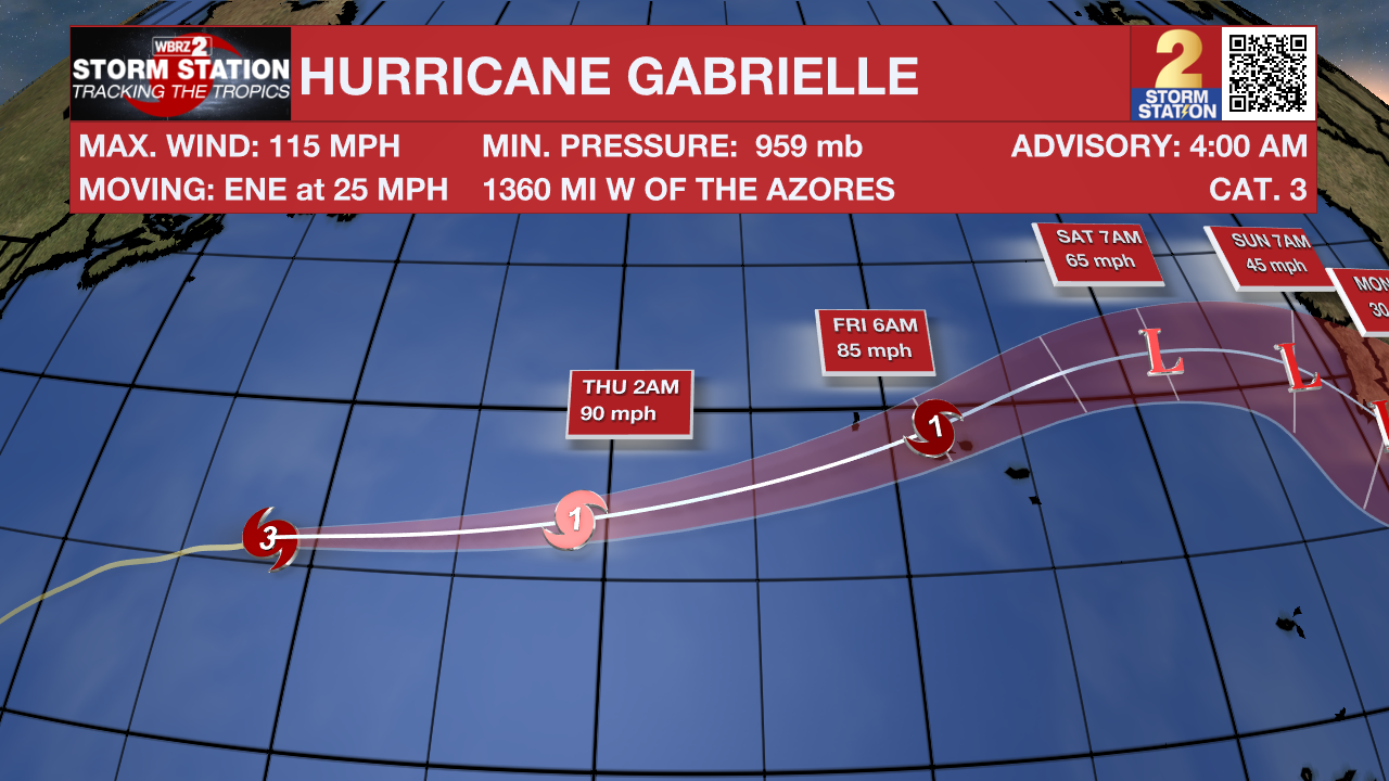
The Tropics: Hurricane Gabrielle is slowly losing strength, with its eye no longer visible on satellite and strong winds weakening slightly to around 115 mph. The storm is moving quickly to the east-northeast and is expected to pass through or near the Azores in about two days before slowing down and turning southeast toward Europe. As it continues over cooler waters and battles stronger wind shear, Gabrielle will keep weakening, but it may still pack strong winds of 85–90 mph when it reaches the Azores. After it transitions into a non-tropical system in a couple of days, it should steadily weaken over the northeast Atlantic.
Trending News
Shower and thunderstorm activity associated with a tropical wave located about 700 miles east of the Leeward Islands continues to show signs of organization. Environmental conditions are forecast to be favorable for further development, and a tropical depression is likely to form during the next couple of days while the system
moves west-northwestward to northwestward into the western tropical Atlantic, well north of the Leeward Islands.
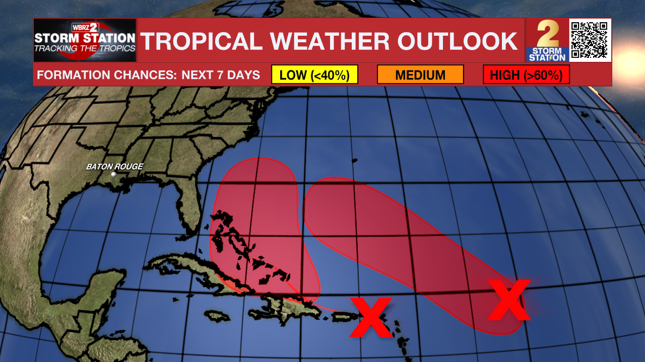
A tropical wave over the northeastern Caribbean Sea continues to produce a large area of disorganized showers, thunderstorms and gusty winds across much of the Windward and Leeward Islands. This wave is expected to move west-northwestward at 15 to 20 mph, spreading heavy rainfall and gusty winds into Puerto Rico and the Virgin Islands today, and across the Dominican Republic beginning tonight. The system is then expected to slow down and turn northwestward when it reaches the southwestern Atlantic in a couple of days. Environmental conditions are forecast to be more conducive for development late this week and weekend, and a tropical depression is likely to form when the disturbance is in the vicinity of the Bahamas.
Get the latest 7-day forecast and real-time weather updates HERE.
Watch live news HERE.
– Balin
The Storm Station is here for you, on every platform. Your weather updates can be found on News 2, wbrz.com, and the WBRZ WX App on your Apple or Android device. Follow WBRZ Weather on Facebook and X for even more weather updates while you are on the go.
More News
