

Latest Weather Blog
Monday Evening Video Forecast
Related Story
Another HEAT ADVISORY has been issued for Tuesday. This one will be in effect for all of South Louisiana, as the heat index will surpass 108° in many spots. Despite being used to sultry summer conditions, this level of heat and humidity can lead to heat illnesses. The advisory merely serves as a reminder to drink plenty of fluids and take it easy outdoors. It’s also smart to check on individuals at higher risk for heat-related illnesses, such as older adults and young children.
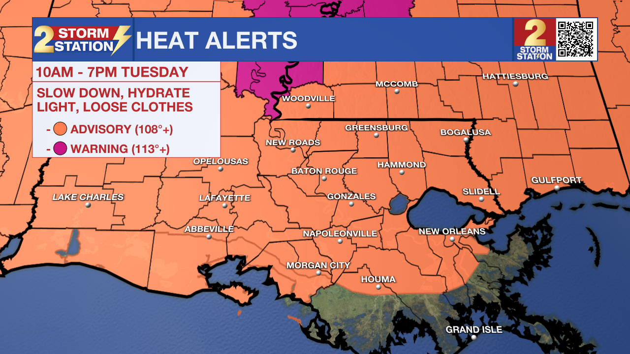
Tonight & Tomorrow: A classic July night lies ahead with mostly clear skies, muggy air, and lows resting in the mid-70s. Ample sunshine will allow temperatures to skyrocket during the day. Highs will again reach the mid 90s with humidity making it feel roughly 10-15° warmer. Some neighborhoods could see a heat index, or feels-like temperature, pushing 112°. That is enough to necessitate another Heat Advisory (see above). Rain will be tough to find; a passing shower will be the exception, not the rule.
Wednesday & Beyond: Another surge of moisture is set to target the Capital Region beginning Wednesday. While the day starts dry with sunshine, isolated showers and storms will return by afternoon or evening. The timing of those storms is still being worked out, and it will play a big role in how hot things get. An additional Heat Advisory might be issued for Wednesday if rain develops later.
A disturbance riding through deep tropical moisture will lead to more numerous thunderstorms to close out the week. Coming in waves, most of the area will experience rain at some point on Thursday and Friday. Moisture left behind will keep daily rain chances in play through the weekend, but with a fewer number of storms overall. Most will see 1-3” of rain during this timeframe, with isolated higher amounts possible, especially near the coast. Widespread flooding doesn’t appear to be a concern this time, but localized flash flooding cannot be ruled out.
The Tropics: A weak area of low pressure approaching the Lesser Antilles has become less organized on Monday. The window for possible tropical formation is getting smaller. The system only has a minimal chance of development in the next day or so.
Get the latest 7-day forecast and real-time weather updates HERE.
Watch live news HERE.
— Meteorologist Malcolm Byron
The Storm Station is here for you, on every platform. Your weather updates can be found on News 2, wbrz.com, and the WBRZ WX App on your Apple or Android device. Follow WBRZ Weather on Facebook and X for even more weather updates while you are on the go.
News
