Saturday morning video forecast
Related Story
After having a lot of sunshine yesterday, today will be the complete opposite. Expect clouds all day long, but no rain. This will eventually change in the near-future.
Easter Weekend Breakdown:
- Saturday: Clouds increase, still warm. No rain - good for Easter egg hunting.
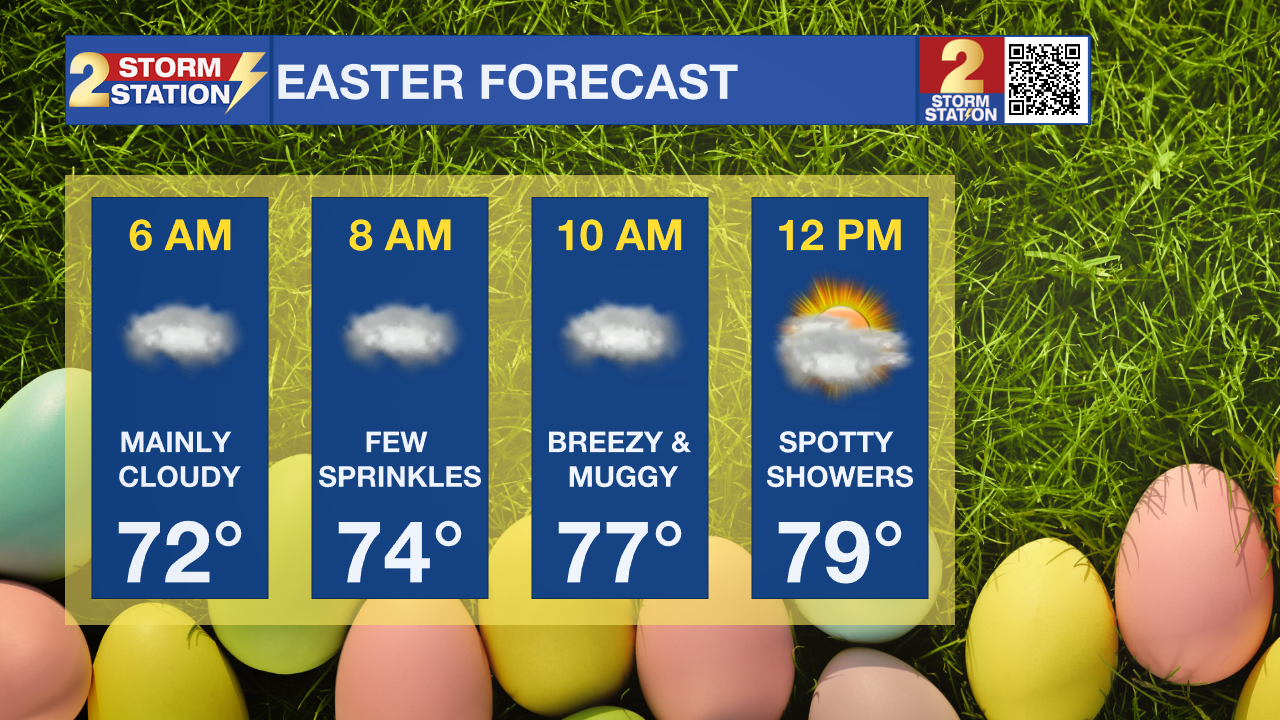
- Sunday: Warm & breezy with a few spotty showers. Grab an umbrella just in case.
Today & Tonight: Clouds are settling in the area, and they are not going anywhere, anytime soon. It will be another warm day, with highs in the mid 80s. Increasing moisture content will lead to it feeling overall more muggy outside. It will stay feeling this way in the overnight hours, with lows near 71 degrees.

Up Next: After the muggy start on Easter day, expect another day with a lot of clouds. Highs will warm into the mid 80s, with mugginess sticking around. Some spotty showers will be possible, especially in the afternoon and evening. No need to cancel any outdoor plans, but have a place to go in case a shower passes by. Moisture content will increase even more next week as a front stalls in the region. This will lead to many days in a row with the chance of showers and thunderstorms. By the end of the week, most will have picked up 1-2" of rain, but isolated higher totals are possible. Other than the rain, it will stay warm all week long, with a lot of clouds in the area.

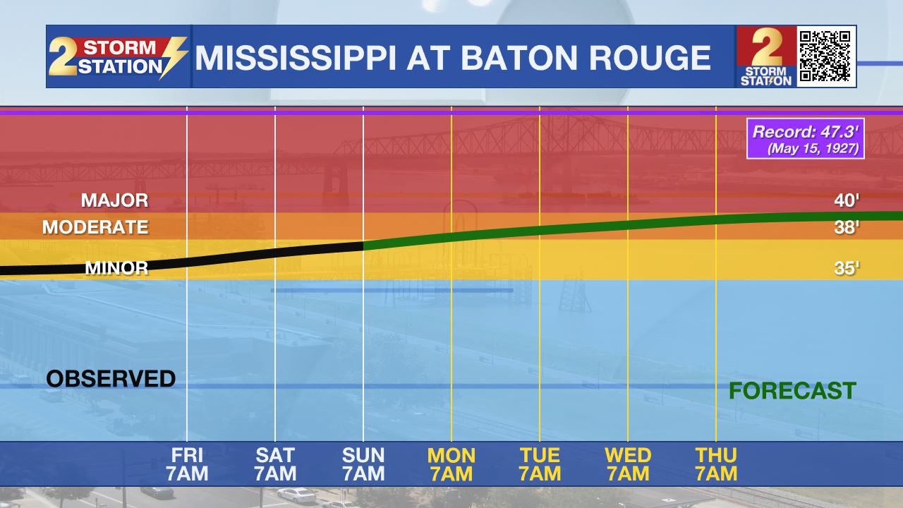
River Flooding: The National Weather Service has issued a RIVER FLOOD WARNING for the Mississippi River at Red River Landing and Baton Rouge until further notice. In addition, a RIVER FLOOD WARNING will go into effect on Monday, April 21 for the Atchafalaya River at Morgan City.
• At Red River Landing, flood stage is at 48 feet. Minor flooding is already occurring. Moderate flooding is expected with a crest near 57.5 feet. Around these levels, Angola farmland on the left bank begins taking on water. Caution is urged when walking near riverbanks. The river will crest by April 25, then fall below flood stage by May 6.
• At Baton Rouge, flood stage is 35 feet. Minor flooding has already begun. Major flood stage will be reached on April 25 with a height of 40.5 feet. Levels will fall below flood stage around May 3. Around these levels, the grounds of the older part of Louisiana State University's campus become soggy. This includes the area around the Veterinary Medicine building, the Veterinary Medicine Annex, and Alex Box Stadium. Levees protect the city of Baton Rouge and the main LSU campus at this level. Caution is urged when walking near riverbanks.
• At Morgan City, flood stage of 6 feet may be reached on Monday. Moderate flooding with a crest of 7 feet is forecast by April 26. At 7 feet, buildings at the foot of Ann Street on the river side of the flood wall will flood as water overtops the Rio Oil Company dock. Buildings on the river side of the Berwick floodwall will flood. River traffic restrictions will be strictly enforced. In addition, backwater flooding could potentially impact portions of areas around Lake Palourde and Stephensville.
Get the latest 7-day forecast and real-time weather updates HERE.
Watch live news HERE.
– Balin
The Storm Station is here for you, on every platform. Your weather updates can be found on News 2, wbrz.com, and the WBRZ WX App on your Apple or Android device. Follow WBRZ Weather on Facebook and X for even more weather updates while you are on the go.


