

Latest Weather Blog
Sunday morning video forecast
Related Story
Heavy rain and storms are possible Sunday morning before conditions gradually improve later in the day. Much warmer-than-normal temperatures will continue across the Capital Region into next week.
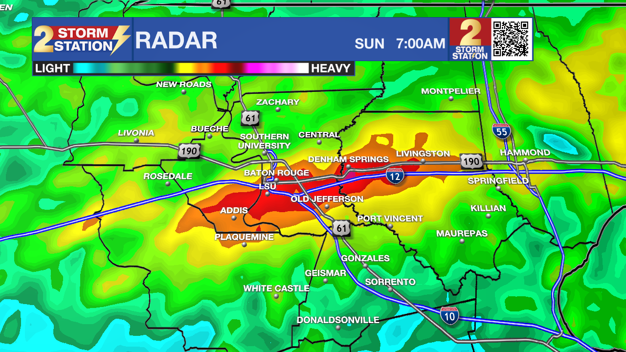
Today and tonight: Hefty rainfall totals overnight caused some minor flooding, which could be aggravated by additional rainfall later this morning and into the afternoon. Showers and thunderstorms are likely Sunday morning as a frontal boundary settles in the region. Periods of heavier rain are possible early in the day, especially if storms redevelop along the Interstate 10 corridor. Some areas could see an additional 1–2 inches of rainfall on top of overnight rain, which may lead to ponding on roads and minor flooding in poor drainage and urban areas.

Use the slider to advance through the next 24 hours of Futurecast
Rain coverage should gradually decrease through the afternoon as the system pushes east and weakens. While severe weather is not expected to be a widespread concern during the day, a few storms could still produce gusty winds and brief heavy downpours before activity ends near sunset. Temperatures will remain well above normal with highs climbing into the lower 80s.

Up Next: The warm pattern continues into the new workweek as high pressure builds back over the Gulf. A few leftover showers could linger on Monday, but many areas should see improving conditions with partly cloudy skies.
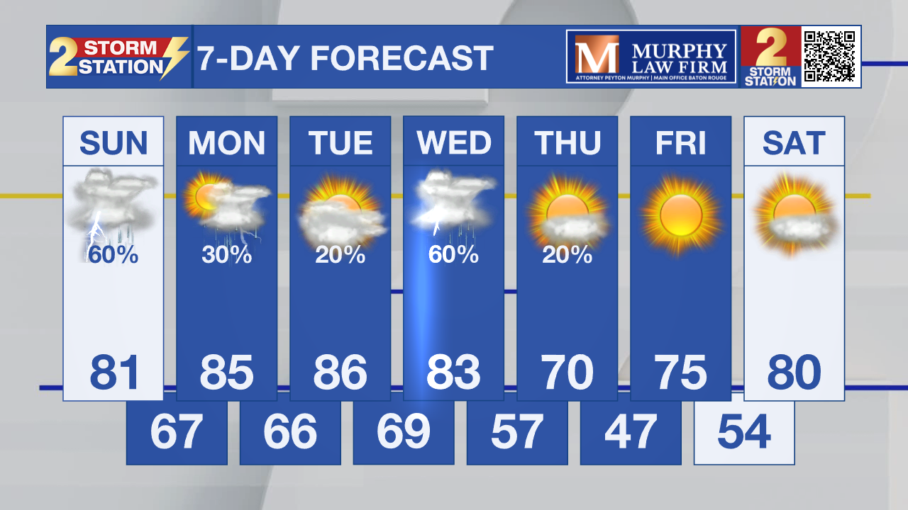
Tuesday looks mainly dry and very warm for early March, with highs once again climbing well into the 80s across much of southeast Louisiana.
What to look out for: The main concern on Sunday will be periods of heavier rainfall during the morning hours. If additional storms redevelop along the Interstate 10 corridor, localized rainfall totals of 1–2 inches could occur, leading to temporary flooding in low-lying and poor drainage areas.
Looking ahead, another system expected around Wednesday could bring another round of showers and thunderstorms to the region, with the potential for stronger storms and heavy rainfall once again.
LSU Sports: LSU Tigers baseball hosts Sacramento State Hornets baseball at Alex Box Stadium in Baton Rouge on Sunday at 6:00 PM to wrap up their weekend series.
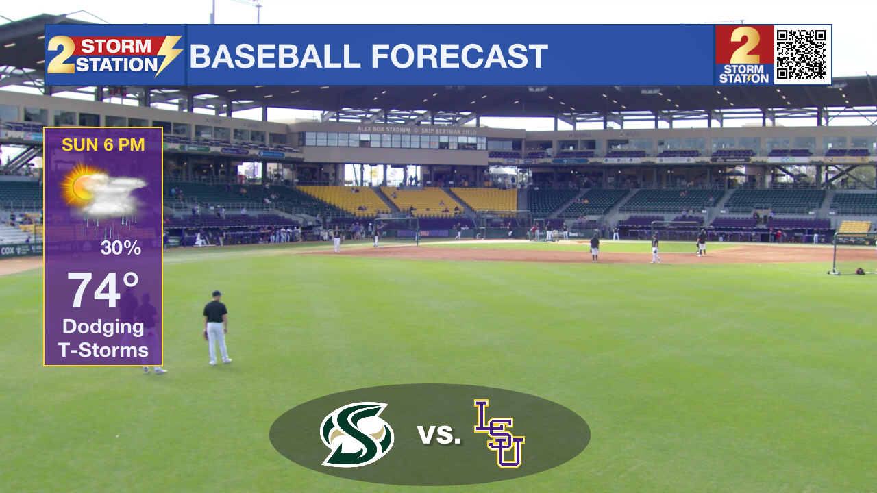
Showers and thunderstorms will likely still be around. While widespread severe weather is not expected during the game window, occasional downpours and lightning delays could still be possible as storms gradually move out of the region. Temperatures will remain warm and humid, but falling into the 70s by evening.
Get the latest 7-day forecast and real-time weather updates HERE.
Watch live news HERE.
– Dave
The Storm Station is here for you, on every platform. Your weather updates can be found on News 2, wbrz.com, and the WBRZ WX App on your Apple or Android device. Follow WBRZ Weather on Facebook and X for even more weather updates while you are on the go.
News
