

Latest Weather Blog
Sunday morning video forecast
Related Story
Sunday will feel like another late-summer scorcher across South Louisiana, with sunshine, light winds, and temperatures in the low to mid 90s. Most of the area stays dry today, but a disturbance moving in from the northwest will bring our best chance for showers and thunderstorms Monday.

Today and Tonight: It will be another mostly sunny and hot day across the Capital Region, with highs from 90 to 95 degrees. Humidity will be high enough to make it feel hotter, but lower dew points should keep most areas just below Heat Advisory criteria. Tonight stays quiet with mostly clear skies and lows in the lower to mid-70s.

Use the slider to advance through the next 24 hours of Futurecast
Up Next: Monday is the day to watch for a change in the pattern. A disturbance moving southeast will help trigger scattered showers and thunderstorms during the afternoon and evening.
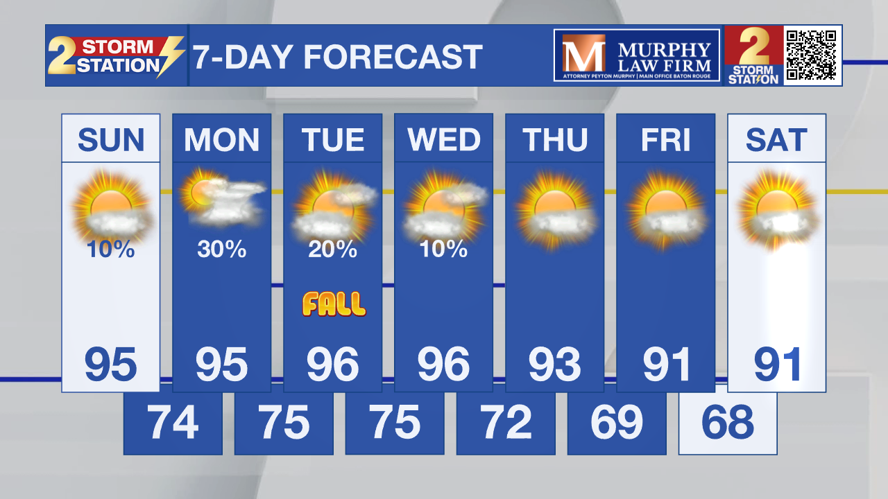
Rain chances will diminish Tuesday, with most areas remaining dry as the disturbance moves east. The upper ridge then rebuilds across the region, keeping the rest of the week mostly dry. Temperatures stay above normal through the week, with highs generally in the low to mid 90s. Friday may bring a slight break from the humidity, but temperatures are expected to remain above average.

Tropics: Tropical Storm Fay is now being monitored by the National Hurricane Center, but it is several hundred miles southwest of the Azores and moving northeast. The NHC does not expect any additional tropical cyclone formation in the Atlantic, Caribbean, or Gulf during the next seven days.
– Dave
Get the latest 7-day forecast and real-time weather updates HERE.
Watch live news HERE.
The Storm Station is here for you, on every platform. Your weather updates can be found on News 2, wbrz.com, and the WBRZ WX App on your Apple or Android device. Follow WBRZ Weather on Facebook and X for even more weather updates while you are on the go.
News

