Thursday Evening Video Forecast
Related Story
A rise in rain chances is trailing close behind the rise in humidity. Storms could play a pivotal role in the forecast for the first part of Labor Day Weekend. Fortunately, another push of drier air may take over during the back half.
Tonight & Tomorrow: The evening will bring a few passing clouds, but the real uptick in cloudiness comes overnight. A stalled front will generate evening and overnight thunderstorms north of the Capital Region. Guided by the front, they will move southeast. A few of these isolated storms cannot be ruled out locally, especially north of I-12. Look for a wake-up temperature in the mid-70s. Storms will expand in coverage on Friday. Though the day will not be a washout, the majority will deal with a downpour at some point. Copious amounts of moisture will lead to storms firing earlier, with rain a possibility during the morning and afternoon. Cloud cover and storms will limit daytime highs to the 80s.
Up Next: Into Saturday, the nearby front will start inching closer to the Capital Region. Acting on lingering moisture, scattered storms will be possible. Still, an all-day washout is not expected. The current thinking is that drier air will push the front closer to the coast on Sunday. Storms would become fewer and farther between in this scenario. Keep monitoring the forecast if you have Labor Day plans over the weekend — the forecast isn’t locked in just yet. There is a world where the front might take a little longer to push south again.
Oddly enough, confidence is a little higher in the extended forecast. Another push of “dry” air appears to invade Labor Day onward. While highs shouldn’t budge from the low 90s, slightly less humid air would make for a more comfortable feel and possibly allow lows to dip into the 60s.
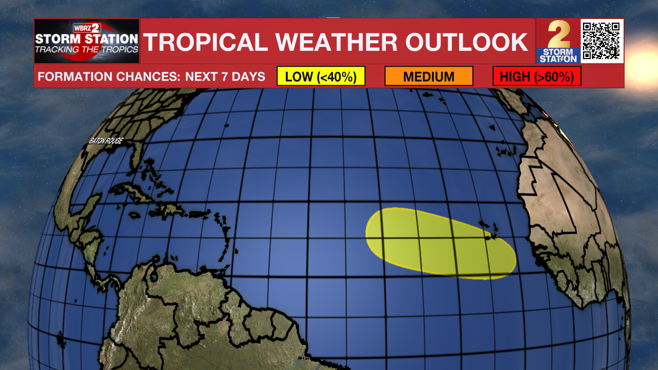
The Tropics: Fernand became post-tropical on Thursday. There are now no active systems across the Atlantic Basin. But there is one area to monitor. A tropical wave will emerge off the west coast of Africa on Sunday. Thereafter, environmental conditions may support slow development of this system while moving through the tropical Atlantic next week.

Get the latest 7-day forecast and real-time weather updates HERE.
Watch live news HERE.
-- Meteorologist Malcolm Byron
The Storm Station is here for you, on every platform. Your weather updates can be found on News 2, wbrz.com, and the WBRZ WX App on your Apple or Android device. Follow WBRZ Weather on Facebook and X for even more weather updates while you are on the go.


