

Latest Weather Blog
Tuesday Afternoon Video Forecast
Related Story
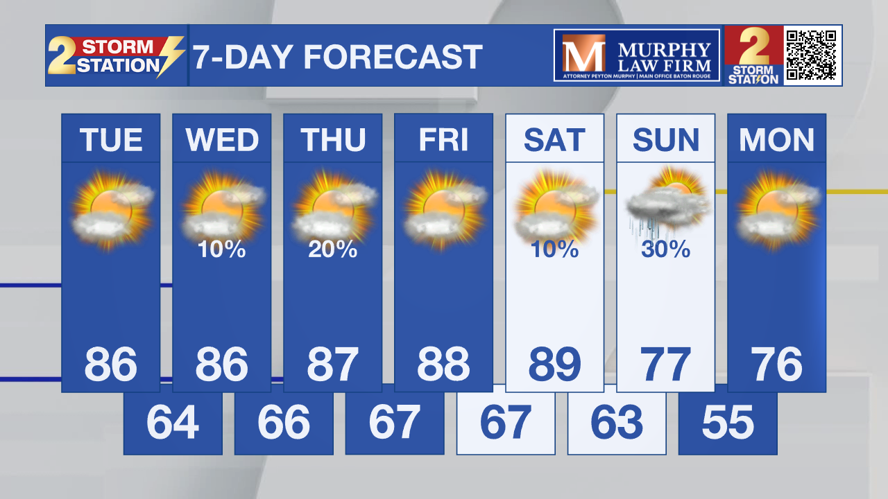
Temperatures will steadily tick higher, and possibly hit the 90° mark by the end of the week. Relief will arrive over the weekend in the form of a cold front.
Today & Tonight: Any patchy fog this morning will quickly burn off after sunrise. For the rest of the day, expect warm temperatures in the mid-80s and partly sunny skies. All outdoor plans are good to go considering we will stay completely dry. Overnight, lows will bottom out in the mid-60s, with a few areas of patchy fog.
Up Next: Our stretch of very warm and dry conditions isn't going anywhere just yet, as this pattern stays locked in through Saturday. We are looking at highs pushing the upper 80s by the tail end of the week, and it’s not out of the question for a few spots to hit that 90° mark. If we do reach 90° in Baton Rouge, we’ll be hitting that milestone more than three weeks earlier than we usually do. With a huge weekend for outdoor events—including the Blues Festival, French Quarter Fest, and LSU Baseball—staying hydrated needs to be your top priority. Don't underestimate the sun, either; even though it’s only mid-April, the solar intensity is equivalent to what we see in mid-August. That means you can catch a sunburn in as little as 20 to 30 minutes, so keep the sunscreen close by!

Expect the heat to finally give way late Saturday as a cold front moves into the region. While the front might spark up some showers, it won’t be enough to ruin your outdoor plans or cause a washout. Even though the rain totals will be fairly minor, the real story is the temperature drop, which will provide some brief relief from the warmth just in time for Sunday.
Get the latest 7-day forecast and real-time weather updates HERE.
Watch live news HERE.
— Balin
The Storm Station is here for you, on every platform. Your weather updates can be found on News 2, wbrz.com, and the WBRZ WX App on your Apple or Android device. Follow WBRZ Weather on Facebook and X for even more weather updates while you are on the go.
News
