

Latest Weather Blog
Wednesday morning video forecast
Related Story
Warm, spring-like weather continues today as dense fog becomes the main concern. Very warm again this afternoon, with another round of widespread fog expected tonight.
.png)
Today and tonight: Christmas Eve starts with patchy fog in spots, but visibility improves by mid-morning. The rest of the day looks quiet and unseasonably warm, with highs climbing into the mid to upper 70s across Baton Rouge and surrounding areas. Humidity stays elevated, and winds remain light. Tonight, conditions turn problematic again as widespread dense fog redevelops, potentially impacting travel late tonight into early Thursday.

Use the slider to advance through the next 24 hours of Futurecast
Up Next: The pattern barely changes heading toward Christmas. High pressure aloft keeps rain chances near zero while warm, humid air continues to flow in from the Gulf. Highs remain well above normal through the end of the week, with some locations flirting with record warmth. Nights stay mild, but fog remains a recurring issue, especially during the overnight and early morning hours.
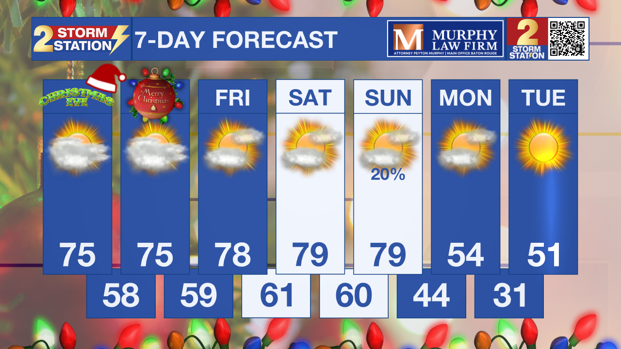
What to look out for: Fog is the main weather hazard, particularly tonight and again early Thursday morning. Visibility may drop quickly in dense fog, especially near waterways and along major travel corridors. With holiday travel and outdoor events picking up, conditions may become hazardous after sunset and before sunrise despite the warm temperatures.
Get the latest 7-day forecast and real-time weather updates HERE.
Watch live news HERE.
– Dave
The Storm Station is here for you, on every platform. Your weather updates can be found on News 2, wbrz.com, and the WBRZ WX App on your Apple or Android device. Follow WBRZ Weather on Facebook and X for even more weather updates while you are on the go.
News
