Latest Weather Blog
Clouds linger early this week across South Louisiana, but a gradual warming trend is on the way. While rain chances stay low for now, increasing winds and rising water levels along the coast will become the bigger story.
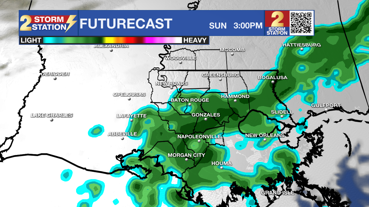
Today and tonight: A few early morning showers are possible, mainly closer to the coast, but most areas will stay dry as activity shifts away through the day. Skies will be partly to mostly cloudy, with a developing drier pattern settling in. Highs will reach near 70 degrees, with a light breeze inland and gustier winds closer to the coast. By tonight, conditions remain quiet with partly cloudy skies and lows in the 40s and 50s.

Use the slider to advance through the next 24 hours of Futurecast
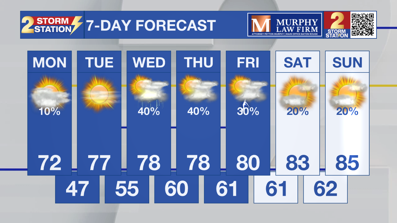
Up Next: A warming trend begins Tuesday and continues through midweek, with temperatures climbing each day. Winds will shift to an easterly direction, helping bring back a bit more moisture by midweek. This could lead to isolated afternoon showers or storms returning Wednesday and Thursday, though coverage remains limited. By late week, highs climb well into the 80s with a more typical spring pattern setting up.

What to look out for: The main concern this week will be increasing easterly winds and rising water levels along the coast. Minor coastal flooding becomes more likely, especially during high tide cycles on Wednesday and Thursday. This could impact east-facing shorelines and tidal lakes, where water may begin to pile up.
Get the latest 7-day forecast and real-time weather updates HERE.
Watch live news HERE.
– Dave
The Storm Station is here for you, on every platform. Your weather updates can be found on News 2, wbrz.com, and the WBRZ WX App on your Apple or Android device. Follow WBRZ Weather on Facebook and X for even more weather updates while you are on the go.


