

Latest Weather Blog
Saturday PM Forecast: A Foggy Start to Sunday. Turning Colder Thanksgiving week
A warm weekend comes to an end as a cold front approaches. Thanksgiving week is shaping up to be much colder, with another system worth watching midweek.

Tonight and Sunday: Another mild, humid night across the Capital Region, with fog possible toward Sunday morning as winds ease. Sunday stays warm, with highs in the upper 70s, but a cold front will approach from the northwest. Rain chances remain low even as moisture increases only modestly and appears fairly shallow. Any activity that develops could be limited to sprinkles or brief light showers.
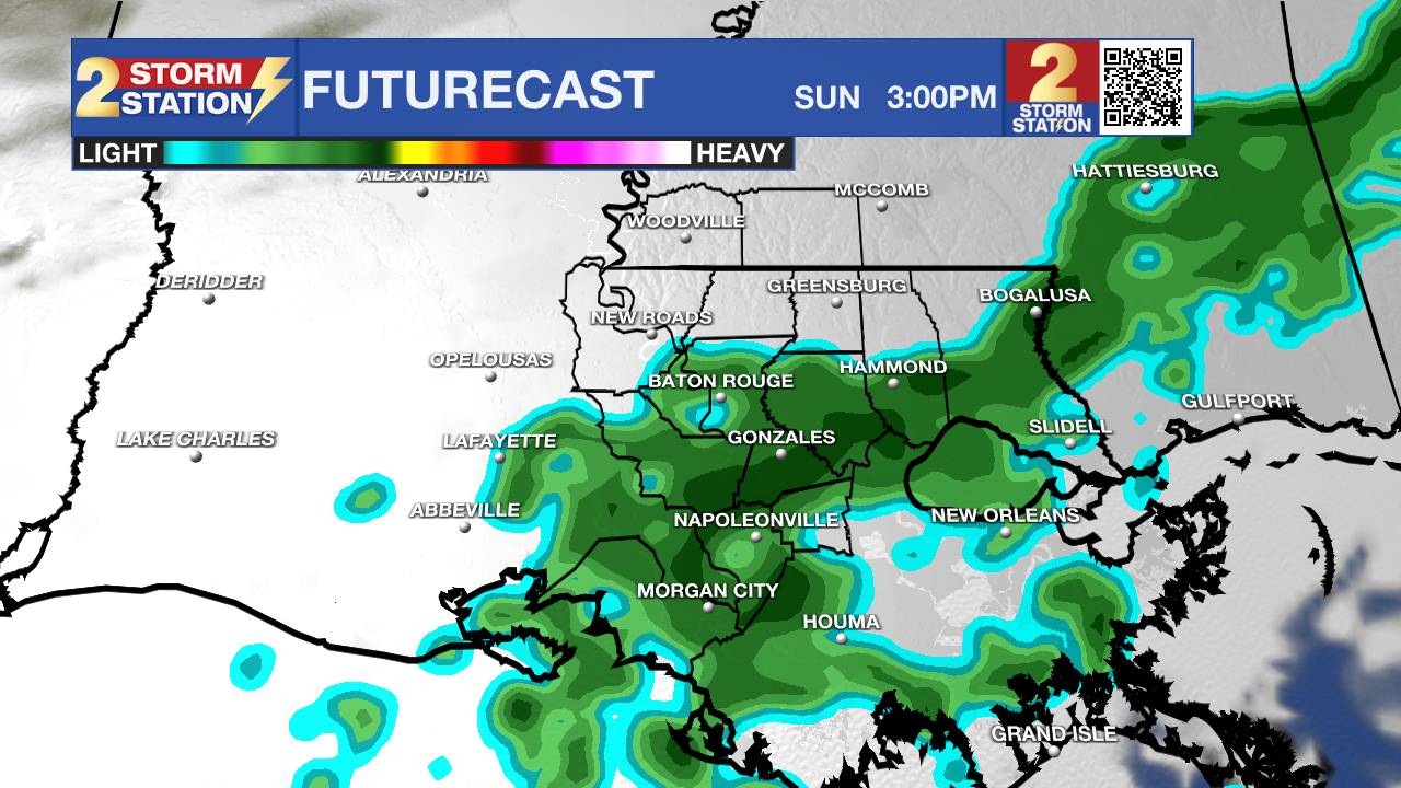
Use the slider to advance through the next 24 hours of Futurecast
The front is expected to move through Sunday night into Monday morning, although timing remains somewhat uncertain. A few showers and possibly isolated thunderstorms could accompany it, but widespread rainfall isn't expected. Some storms may develop during the daytime on Monday, but the overall severe threat appears low.
Trending News
Up Next: Cooler air begins filtering in behind the front early next week. Monday's temperatures will depend on how quickly the boundary moves through, with some additional warming possible ahead of it. Tuesday should generally be drier, although a lingering boundary could produce a low-end rain chance.
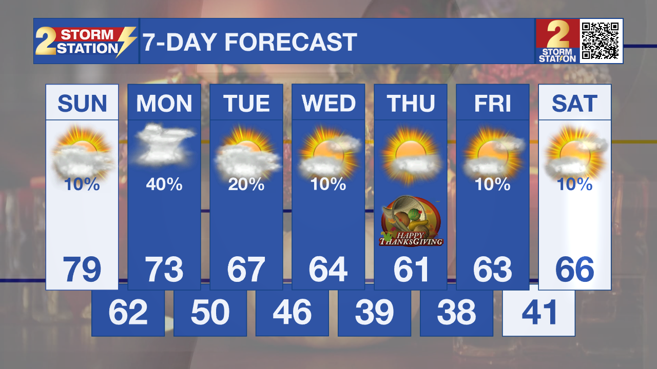
Temperatures trend downward again Wednesday through Friday as another push of colder air arrives. We're also watching a disturbance that could affect the region around Wednesday, but forecast models remain inconsistent on its timing and precipitation potential. The more reliable signal is for a colder-than-normal Thanksgiving. Black Friday shoppers should prepare for a chilly start, with temperatures remaining cool through the end of the week.
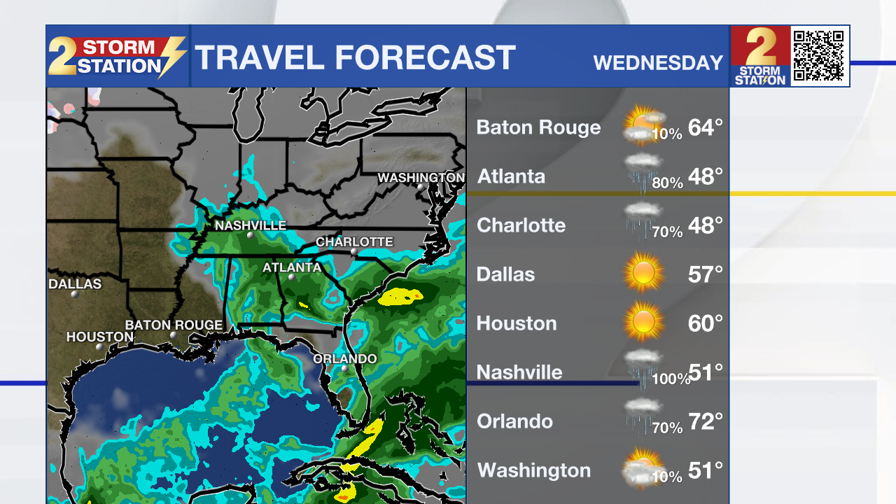
Thanksgiving Travel: Travel across the South on Tuesday and Wednesday looks generally favorable, with no widespread travel-disrupting weather expected at this time. A colder air mass will be settling into the region, so travelers should plan for chilly mornings and cooler temperatures. We're also monitoring a midweek disturbance that could bring additional clouds and possibly some showers on Wednesday, although the track and rain potential remain uncertain.
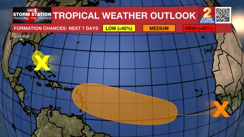
Tropics: The National Hurricane Center is monitoring a large non-tropical low-pressure system near Florida. It is moving into an environment unfavorable for significant tropical or subtropical development. Despite the low development potential, the system is expected to produce gusty winds, dangerous surf, rip currents, and coastal flooding along portions of the Southeast and Mid-Atlantic coasts into early next week.
- Dave
Get the latest 7-day forecast and real-time weather updates HERE.
Watch live news HERE.
The Storm Station is here for you, on every platform. Your weather updates can be found on News 2, wbrz.com, and the WBRZ WX App on your Apple or Android device. Follow WBRZ Weather on Facebook and X for even more weather updates while you are on the go.
More News

