

Latest Weather Blog
Tuesday AM Forecast: Summertime steam returns, Fuels daily pop-up storms
Hot and humid weather dominates this week with highs in the low-90s and lows in the mid-70s. A few afternoon storms may pop up each day, but no major impacts are expected as students and teachers head back to class this week.
Today & Tonight: The classic “sticky” summer air makes a return to Baton Rouge on Tuesday. Expect a typical early August day: a warm start in the mid-70s, climbing to the low-90s by afternoon with a mix of sun and clouds. A few pop-up storms are possible in the afternoon, bringing brief downpours to about 30% of the area. As usual, once the sun sets and daytime heating fades, any leftover showers will fizzle out. Skies will clear overnight, and temperatures will dip back into the mid-70s.
Up Next: A similar weather pattern will stick around through the end of the week. Isolated afternoon storms could pop up around school pick-up or during after-school activities. Still, storm location will vary daily, and only about 20–30% of the Capital Area will see rain each day. Expect daily highs in the low to mid-90s and lows in the low to mid-70s with plenty of sunshine each day.
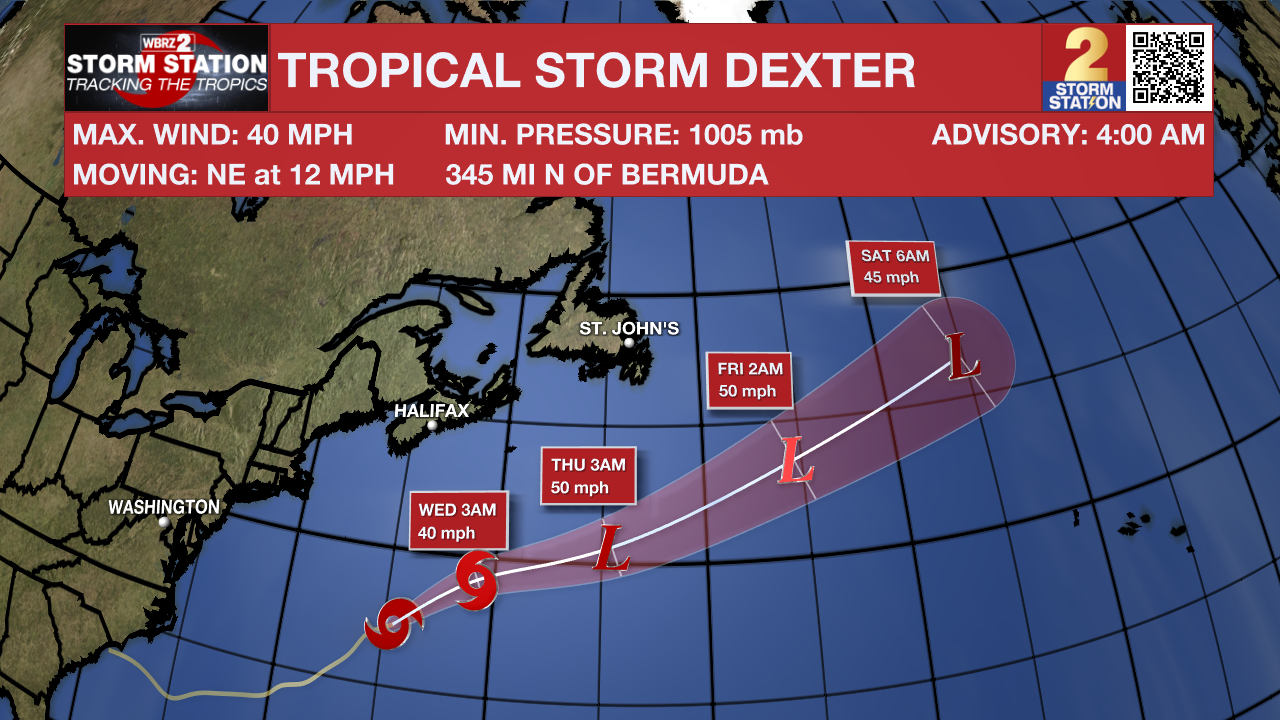
The Tropics: Tropical Storm Dexter continues to move its way through the North Atlantic early Tuesday morning. The storm may intensify in the next day or so, but only slightly. Dexter is not expected to become a hurricane as it carves out a northeastward path. Fortunately, the system will avoid land entirely and become post-tropical by late week.
There are also a few other areas the Storm Station and National Hurricane Center are keeping an eye on:
Off the Southeast U.S.: A weak surface trough currently located several hundred miles off the coast of the southeastern United States is expected to form an area of low pressure in a day or so. Thereafter, environmental conditions appear favorable for the gradual development of this system, and a tropical depression could form by the latter portion of this
week or weekend as the low initially moves slowly westward, but turns more northward by this weekend.
Trending News
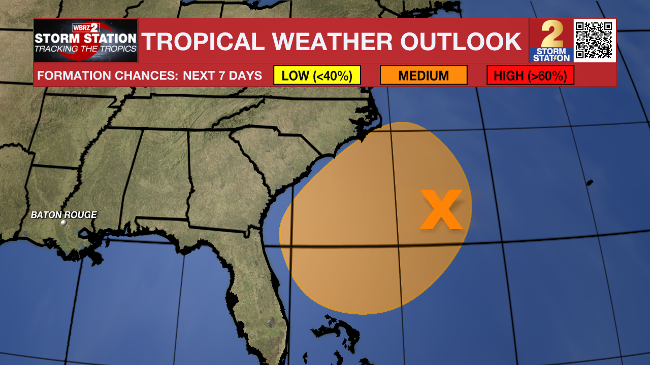
Central Tropical Atlantic: A tropical wave over the far eastern tropical Atlantic is currently producing minimal shower activity. Environmental conditions are expected to be conducive for gradual development during the next few days, and a tropical depression could form late this week or over the weekend as the system moves generally west-northwestward
across the central tropical or subtropical Atlantic.
Get the latest 7-day forecast and real-time weather updates HERE.
Watch live news HERE.
- Emma Kate C.
The Storm Station is here for you, on every platform. Your weather updates can be found on News 2, wbrz.com, and the WBRZ WX App on your Apple or Android device. Follow WBRZ Weather on Facebook and X for even more weather updates while you are on the go.
More News
