

Latest Weather Blog
Wednesday PM Forecast: crisp air continues until weekend rainmaker arrives
Expect sunshine and comfortable conditions through Friday. Try to enjoy the pleasant conditions outdoors because a substantial storm system will roll in for the weekend.
Rest of the Week: Not much will be going on in skies other than some passing clouds at times, especially Thursday. High temperatures will hover in the low 80s. Low temperatures will be crisp in the low to mid 50s.
Friday Night Blitz: After a somewhat muggy night last Friday, clear and comfortable weather returns for high school action this week. Temperatures will cool through the 70s during the games, possibly reaching the 60s in some neighborhoods, so you might want to take an extra layer.
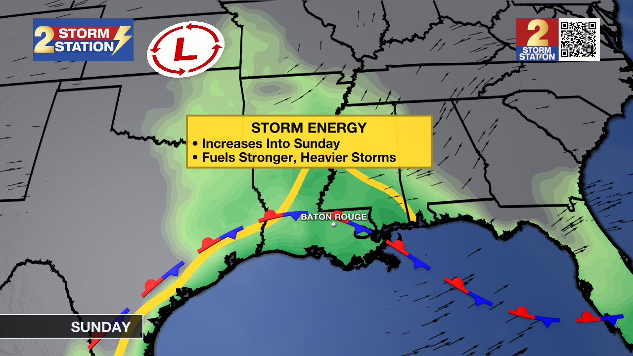
Weekend: A developing storm system will arrive over the weekend with the potential to bring locally heavy rainfall and even a few strong thunderstorms to the Baton Rouge area. Timing will be the critical detail that comes into focus through the end of the week, and that’s how the forecast that follows could be adjusted. Saturday will be mainly cloudy and a touch muggy with highs in the low 80s. Isolated to scattered showers could begin as early as the afternoon hours. Rain is expected to ramp up in coverage and intensity overnight and into Sunday. Any thunderstorms during this period could cause gusty winds and downpours. In fact, rain could come quickly enough that some street and poor drainage flooding could occur. All told, through Sunday, 1-3 inches is expected, which would be a beneficial soak for most locations, as long as it does not fall too fast.
Trending News
LSU & Southern Football: Be ready to battle the elements for your tailgate and game plans. The good news is that the day does not look like it will be a washout, and thunderstorms should be limited during the daytime hours. Be aware of a safe lightning shelter just in case while tailgating, in addition to having a poncho or umbrella on hand for passing showers. The forecast gets a little more murky by kickoff, at 4 p.m. for Southern and 6:30 p.m. for LSU. During the late afternoon and early evening is when rain and thunderstorm activity has the potential to pick up in coverage and intensity. Take some rain gear into the games and monitor the Storm Station forecast for updates.
Next Week: The atmosphere will become less supportive of widespread rain for the beginning of next week. However, it will remain mild and muggy enough to support a mention of spotty showers Monday and Tuesday. Each day, temperatures will feature highs in the 80s and lows in the 60s. By the middle of next week, a much stronger front and push of cooler air is expected. Temperatures may be below average heading into Halloween, indicating some highs in the low 70s and lows in the upper 40s.

The Tropics: Tropical Storm Melissa remains disorganized and is moving very slowly westward at only 2 mph. It is currently located about 315 miles southeast of Jamaica. The storm is expected to continue its slow movement before turning northwest and north, bringing it closer to Jamaica and the southwestern portion of Haiti later this week. Melissa has maximum sustained winds of 50 mph, and with gradual strengthening expected over the next few days, Melissa could become a hurricane by Friday. Heavy rainfall and flooding are expected over portions of Hispaniola and Jamaica for the remainder of this week. A period of rapid intensification will be possible into next week, with Melissa likely becoming a major hurricane.
Get the latest 7-day forecast and real-time weather updates HERE.
Watch live news HERE.
– Josh
The Storm Station is here for you, on every platform. Your weather updates can be found on News 2, wbrz.com, and the WBRZ WX App on your Apple or Android device. Follow WBRZ Weather on Facebook and X for even more weather updates while you are on the go.
More News
