

Latest Weather Blog
Wednesday PM Forecast: hotter afternoons up ahead
Scattered showers and thunderstorms will taper in the days ahead, giving rise to hotter afternoon temperatures. Independence Day and Saturday will both be mainly dry with highs in the mid-90s.
Tonight & Tomorrow: Some remnant showers could dance around through midnight, but these will be the exception rather than the rule. Overnight lows will bottom out in the mid-70s. On Thursday, a weak front will settle south and east of the Metro Area, allowing some slightly drier air to infiltrate. We likely will not sense any significant difference, but may observe a less active radar. Rain coverage will slip into the 20% range. Afternoon highs will peak in the mid-90s.
Independence Day & Saturday: It will be hard to find many spotty showers and thunderstorms early in he holiday weekend. A lot of sunshine is expected. Expect highs in the mid-90s both days. Though a tad lower, enough humidity will be present to cause heat index values near 105 degrees at times. Stay hydrated and take breaks in the shade or air conditioning while celebrating Independence Day. For WBRZ’S Fireworks on the Mississippi, lingering clouds should diminish to mainly clear skies, and temperatures will ease out of the 90s into the 80s.
Looking Beyond: Sunday through Tuesday, the drier spell could reverse slightly. A bit more moisture will work into the atmosphere, helping to ignite isolated to scattered showers and thunderstorms. Thanks to a pocket of disturbed air aloft, the showers and thunderstorms may not necessarily be limited to afternoons, but will be enhanced by daytime heating.
Trending News
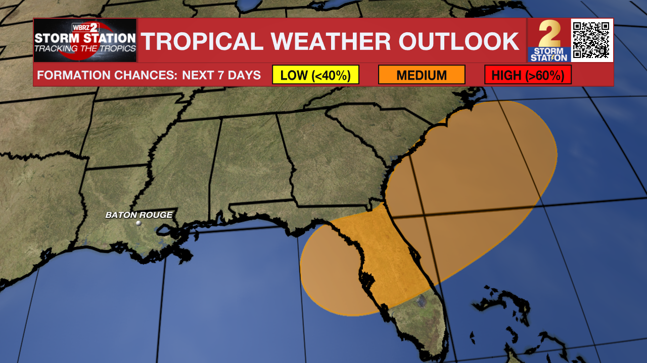
The Tropics: An area of low pressure could develop near the southeast U.S. Atlantic or Gulf coasts by this weekend along a weakening front. Environmental conditions appear only marginally conducive for some development, but a tropical or subtropical depression could form in this region over the weekend or early next week while the system drifts northward or northeastward. Regardless of development, heavy rainfall is possible across portions of the southeast U.S., particularly across the west-central Florida coast.
Get the latest 7-day forecast and real-time weather updates HERE.
Watch live news HERE.
– Josh
The Storm Station is here for you, on every platform. Your weather updates can be found on News 2, wbrz.com, and the WBRZ WX App on your Apple or Android device. Follow WBRZ Weather on Facebook and X for even more weather updates while you are on the go.
More News
