

Latest Weather Blog
Wednesday PM Forecast: late season tropical system, cold front impact weather into Thanksgiving Week
Quiet but mild weather will stick around through Saturday. By the end of the weekend, a tropical system in the southwestern Atlantic and an approaching cold front will coincide to bring some rain chances and temperature changes.
Warming: highs back to the upper 70s late week into the weekend
Cold Front: showers, lower temperatures Sunday into next week
Wait and See: potential rainy stretch next week on hold due to developing tropical system

Trending News
Tonight and Tomorrow: Persistent northeast breezes will continue pushing low-level moisture into the region, keeping a fair amount of clouds overhead. Clouds will prevent low temperatures from dropping too far past the upper 50s. On Thursday, a stubborn area of low pressure spinning out in the open Gulf will continue to spew some clouds inland across coastal Louisiana and Mississippi. Locations closer to the coast will hold onto thicker cloud cover a bit longer, and high temperatures will remain in the upper 60s or low 70s. Farther inland, thinner clouds and breaks of sun will help high temperatures reach the mid to upper 70s.
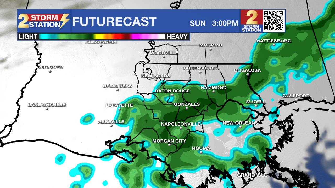
Use the slider to advance through the next 24 hours of Futurecast
Up Next: Friday and Saturday will bring much of the same quiet pattern, with afternoon highs reaching the upper 70s. Skies will feature a mix of sun and clouds with a token 10% rain coverage for the possibility of a passing light shower or sprinkles.
A weak cold front will approach from the north on Sunday, introducing the possibility of a few showers and more clouds. There should be some dry time with highs still hitting the mid to upper 70s. Outdoor plans will be doable; just be aware of a nuisance shower or two.
The forecast is tricky next week due to the possibility of a storm system (possibly tropical) developing off the East Coast of the United States. Such a feature may drag a front further offshore, drying the atmosphere enough to prevent organized rain Monday through Wednesday. However, should this front stall closer to the coast, a storm system approaching from the west may be able to activate showers or a period of rain during that same period – which could have an impact on holiday travel. Confidence in which scenario will pan out should begin to increase over the weekend once weather balloons are able to sample the energy associated with each system. In either case, temperatures are expected to fall back closer to or even below average early next week, with highs in the 60s and lows in the 50s.
Get the latest 7-day forecast and real-time weather updates HERE.
Watch live news HERE.
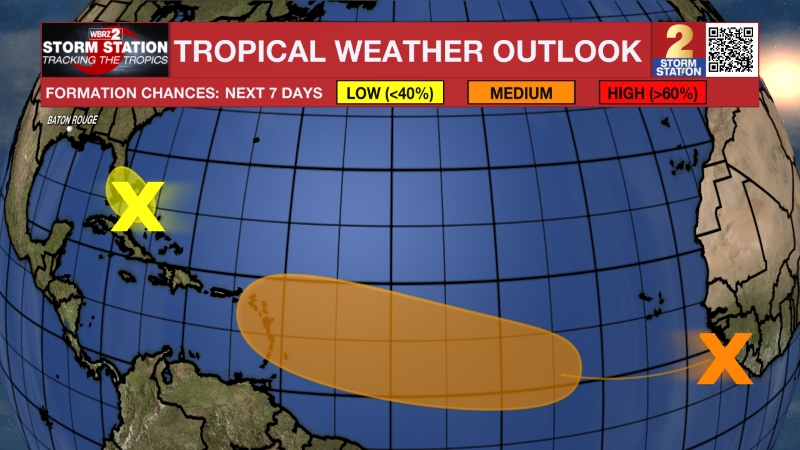
The Tropics: A non-tropical low-pressure system will form near the northern Bahamas by late Friday and likely develop into a subtropical or tropical storm as it tracks northward along the southeastern U.S. coast this weekend. It has a medium chance of formation. This system will stay well east of the Gulf Coast and will pose no threat to Louisiana or Mississippi, though it could influence the local weather (see above).
– Josh
The Storm Station is here for you, on every platform. Your weather updates can be found on News 2, wbrz.com, and the WBRZ WX App on your Apple or Android device. Follow WBRZ Weather on Facebook and X for even more weather updates while you are on the go.
More News

