

Latest Weather Blog
A Severe Thunderstorm Watch remains in effect for Baton Rouge and areas north
The National Weather Service has issued a Severe Thunderstorm Watch for East Baton Rouge, West Baton Rouge, East Feliciana, Livingston, Pointe Coupee, St. Helena, Tangipahoa, and West Feliciana Parishes, as well as Amite and Wilkinson Counties until 9 p.m. Wednesday.
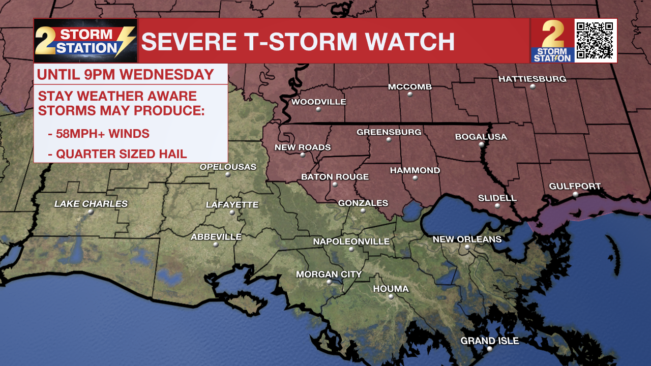
A SEVERE THUNDERSTORM WATCH means conditions are favorable for damaging winds and/or large hail in and around the watch area. Be on the lookout for threatening weather conditions and listen for later statements and possible warnings. If a Severe Thunderstorm Warning is issued, shelter in a sturdy, enclosed building. Ensure your pets have adequate shelter, and try to avoid covered decks, large rooms, and sheds. For more on severe thunderstorm safety, CLICK HERE.
Storm clusters are forecast to intensify as they approach the Louisiana-Mississippi state line, likely arriving as early as 4 to 6 p.m. By nightfall, these storms could push as far south as the I-10/12 corridor. The most severe cells will be capable of producing large hail, damaging wind gusts of 55–70 mph, and the potential for a brief spin-up tornado.

Tonight & Tomorrow: Showers and thunderstorms will be concentrated primarily along and north of the I-10/12 corridor into the early evening hours. A Severe Thunderstorm Watch will expire in this region at 9 p.m., but the potential for rain will persist beyond that time. Off-and-on light showers are possible into Thursday morning as a cold front pushes into the area. As a result, lows will trend a few degrees cooler, bottoming out in the mid-to-upper 60s.
As the front stalls over the region on Thursday, intermittent showers remain in the forecast. While it won't be a total washout, keep an umbrella close. The Storm Station will also be keeping an eye out for another flare-up of heavier thunderstorms late in the day, possibly lasting into the evening. The frontal influence will create a stark north-to-south temperature contrast with cooler highs in the 70s in southwest Mississippi and warmer temperatures closer to 80° along and south of the I-10/12 corridor.
Trending News

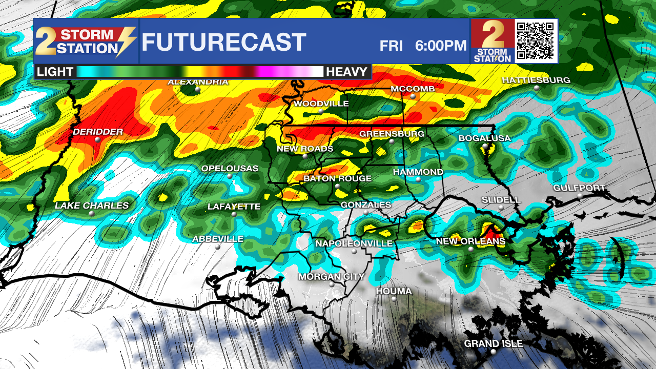
Up Next: The stalled front will play an even bigger role in the forecast on Friday as it interacts with a piece of energy in the atmosphere. Showers and thunderstorms will grow more numerous as the day progresses, keeping temperatures in the 60s for much of the day. Widespread rain will take over by late afternoon, potentially grinding the commute home to a halt. Rain will be steady, or even heavy at times, on Friday night as several inches of rain fall in the Capital Area. By the time rain wraps up early Saturday, most are looking at 2-4" of rain as a baseline, though there may be a few pockets pushing 4"+.
Friday night's rainmaker is trending even quicker, setting up a drier weekend. Aside from a few light showers on Saturday morning, most of the day is now looking dry and notably cooler with a high in the low 70s. Sunday will begin crisp with lows in the upper 40s, followed by a mainly sunny afternoon with highs in the mid-70s. Sunshine will continue dominating into next week, with temperatures gradually rebounding.
Get the latest 7-day forecast and real-time weather updates HERE.
Watch live news HERE.
More News
