

Latest Weather Blog
Monday AM Forecast: Scattered storms this week, tropical depression could form soon
Today & Tonight: Storms are already firing up along the coast this morning, with a few showers sneaking farther inland. Much like Sunday, this early activity could send some clouds drifting toward the Metro Area before midday. If they hang around, they may slow our temperature climb at first. Still, sunshine should win out by the afternoon, pushing highs into the low 90s. That heat will be enough to trigger scattered, hit-or-miss thunderstorms—some of which could line up with the afternoon commute or after-school plans. Storm chances fade later in the evening, and overnight lows will settle into the mid-70s.
Up Next: Tropical moisture will linger over the region for now, keeping scattered thunderstorms in the forecast through midweek—mainly during the afternoons. Temperatures won’t change much, with highs in the low 90s and lows in the mid-70s. By late week into the weekend, storm chances will drop to more isolated levels. That won’t mean completely dry conditions, but with fewer storms around, highs will have room to climb into the mid-90s by the weekend.
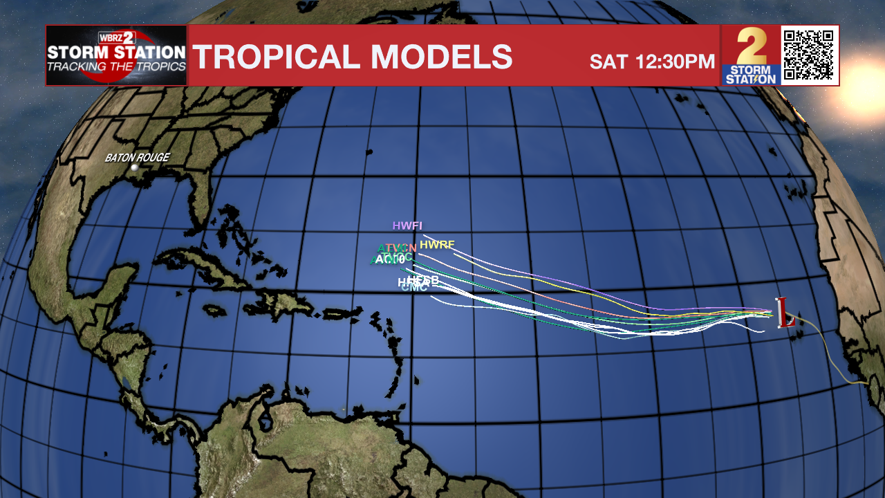
The Tropics: Across the basin, the main feature to watch is a tropical wave located just east of the Cabo Verde Islands. Showers and thunderstorms tied to this system have been gradually becoming more organized, and only a slight boost in that organization could lead to the formation of a tropical depression—possibly within the next day or so. Even if development doesn’t occur in the next 24–48 hours, it remains likely later this week as the system moves westward through the tropical Atlantic. The next name on the list is Erin.
For now, steering winds will carry the disturbance west, but forecast confidence drops as it nears the Leeward Islands later in the week. Beyond that point, the track could range from turning out to sea to continuing west into the Gulf. It’s still much too early to talk about any possible U.S. impacts—if they happen at all. At this stage, it’s simply a system to keep an eye on, with no immediate threat. Stay tuned to the Storm Station for updates.
Trending News
Meanwhile, another area of thunderstorms is located farther north over the central tropical Atlantic. While gradual development is possible around midweek, overall odds appear low at this time. This system will not be a threat to land.
Get the latest 7-day forecast and real-time weather updates HERE.
Watch live news HERE.
— Balin
The Storm Station is here for you, on every platform. Your weather updates can be found on News 2, wbrz.com, and the WBRZ WX App on your Apple or Android device. Follow WBRZ Weather on Facebook and X for even more weather updates while you are on the go.
More News
