

Latest Weather Blog
Friday PM Forecast: Isaias to make landfall tonight, sets up a nice weekend locally
Once Hurricane Isaias makes landfall and moves inland, northerly winds will channel cooler, drier air into the area. This will pave the way for a pleasant weekend. Get out and enjoy it, because warmer weather makes a quick comeback into next week
Tonight & Tomorrow: With Isaias making landfall well to the east, local impacts will be minimal into Saturday. A passing shower remains possible overnight, but rain will be the exception rather than the rule. Expect only a few passing clouds with lows dropping into the low-to-mid 60s by dawn. Sunshine now appears to dominate even more so on Saturday. Bright skies will nudge highs into the mid-80s, a welcome tick down compared to recent days.
As Isaias pulls farther inland, it will continue to drive a breezy north wind, sustained at 10-20 mph with higher gusts topping 30 mph. Until the wind subsides during the evening, wind-driven tides could raise water levels by 1-3 feet in low-lying areas near the tidal lakes and along the coast.
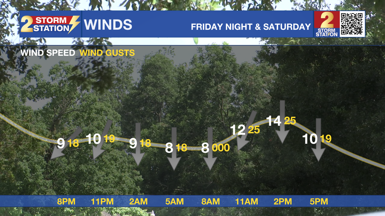
Saturday brings a clearing trend as lingering moisture departs, clearing the way for brighter skies by afternoon. A north wind on the back side of Isaias ushers in cooler air, holding daytime highs in the upper 70s to low 80s. With dew points dropping alongside the temperature, Sunday morning will feature a distinct fall-like chill, with lows dipping into the upper 50s and lower 60s.

Up Next: Clear skies, light winds, and low humidity will set up a cool start to Sunday. With morning lows in the upper 50s to low 60s, that would be some of the coolest air since last spring. However, expect a swift warm-up on Sunday afternoon with highs returning to 90°. 90s will stay for much of next week, with humidity levels creeping up too. Rain will be hard to find for the next week.
Trending News
Get the latest 7-day forecast and real-time weather updates HERE.
Watch live news HERE.
The Tropics: Isaias became a major Category 3 hurricane on Friday, with maximum sustained winds hitting 120 mph at peak intensity. Wind shear is starting to battle the storm as it nears the coast, reducing its intensity on approach. However, it's too little too late. A dangerous hurricane will make landfall on Friday evening in the Florida Panhandle. Strong gusty winds, flash flooding, storm surge, and tornadoes are likely in the region. The remnants of Isaias will push north through the weekend, bringing rain into Kentucky that could impact LSU’s road matchup against the Wildcats.

— Meteorologist Malcolm Byron
The Storm Station is here for you, on every platform. Your weather updates can be found on News 2, wbrz.com, and the WBRZ WX App on your Apple or Android device. Follow WBRZ Weather on Facebook and X for even more weather updates while you are on the go.
More News

