

Latest Weather Blog
Tuesday PM Forecast: One week of intense heat down, and still more to come
Late-afternoon thunderstorms will offer the only relief from the unrelenting heat. Even then, the heat does not disappear. Very warm mornings in the mid-to-upper 70s will give way to scorching afternoons in the upper 90s throughout the Storm Station 7-Day forecast.
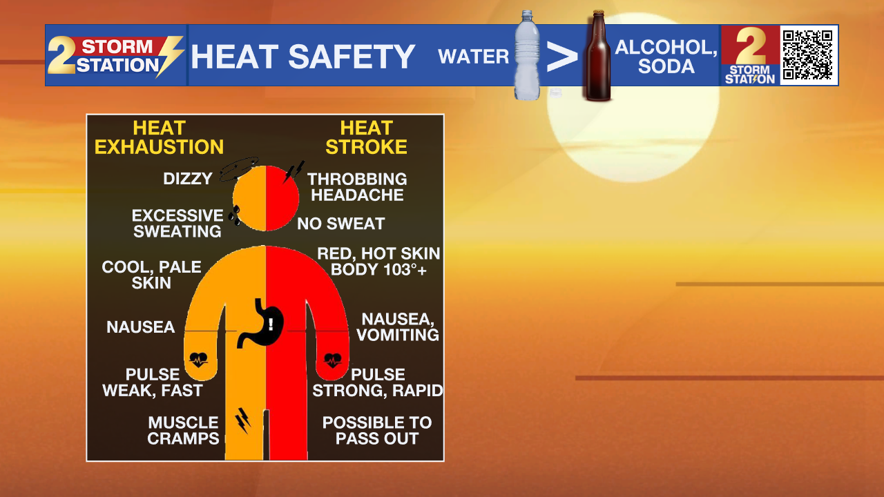
A Heat Advisory will be in effect for the entire Capital Area from 11 a.m. to 8 p.m. Wednesday. The heat index, or feels-like temperature, will be in the triple digits for several hours, likely topping out near 110°. Take frequent breaks in the shade, stay well-hydrated, and watch for signs of heat exhaustion and heatstroke. Now that the intense heat has been ongoing for over a week, remember that the effects of it stack up over time. As it continues, consider checking in with friends and family — especially the elderly or anyone without access to A/C.
Tonight & Tomorrow: Like clockwork, afternoon thunderstorms will fade fast toward sunset. Only a few leftover clouds will remain, and temperatures will stay in the 80s for most of the night. Wednesday will begin quietly with a low barely dipping into the upper 70s, setting up another hot afternoon as temperatures find the mid-to-upper 90s. Relentless humidity will make it feel roughly 10° hotter. Isolated afternoon thunderstorms might help cool things off in a few lucky neighborhoods, but the storm coverage won’t pick up until after peak heating. Storms won’t hit every location on any given afternoon; however, areas that do experience them will face heavy rain and gusty winds.

Up Next: The rest of the week brings more of the same, with high temperatures stuck in the upper 90s through the weekend and well into next week. Additional heat alerts are likely as the week wears on. Spotty to isolated thunderstorms will remain a possibility as well, though most won’t develop until the afternoon heat peaks. Because these storms will be hit-or-miss in nature, they won’t be an everyday occurrence. Steamy conditions will keep lows tucked in the mid-to-upper-70s at night, placing more strain on A/C systems and making it harder for bodies to recharge — especially for those without access to A/C.
Trending News
Get the latest 7-day forecast and real-time weather updates HERE.
Watch live news HERE.
The Tropics: No tropical development is expected over the next seven days across the North Atlantic, Gulf, and Caribbean.
— Meteorologist Malcolm Byron
The Storm Station is here for you, on every platform. Your weather updates can be found on News 2, wbrz.com, and the WBRZ WX App on your Apple or Android device. Follow WBRZ Weather on Facebook and X for even more weather updates while you are on the go.
More News

